A sacred lake in a volcanic crater, less than an hour from Quetzaltenango and surrounded by cloud forest all year round. The Chicabal volcano isn’t the highest in Guatemala, but it has something that very few places in the country can offer: an active Mayan ceremonial lake right in the crater, where the Mam communities have been holding their ceremonies for centuries. In this guide, we explain how to get there, what to expect along the way and everything you need to know before visiting.
What is the Chicabal volcano?
An extinct volcano with a dark green lake in its crater, surrounded by cloud forest right up to its very edge. For the Mam indigenous communities in the area, this place is not a tourist destination: it's an active place of worship. For visitors from outside the area, it's one of the most powerful natural experiences in western Guatemala.
Characteristics of the Chicabal volcano
Chicabal is a maar-type volcano: it lacks the tall, symmetrical cone we usually associate with volcanoes. It was formed when rising magma came into contact with groundwater, triggering an explosion which, rather than building upwards, carved out a depression. The result is a circular crater which, over the centuries, gradually filled with water. Volcanoes of this type are very rare in the Guatemalan volcanic chain, where almost all are stratovolcanoes with steep cones. That alone makes it different from the outset.
The volcano is extinct. There is no volcanic activity whatsoever.

Height and location of the volcano
- Altitude: 2,900 metres above sea level
- Altitude of the lake: approximately 2,712 metres above sea level.
- Type: maar volcano, extinct
- Location: San Martín Sacatepéquez, Quetzaltenango department, Guatemala
- Admission: Q15 per person
- Opening hours: Monday to Sunday, 8.00 am to 4.00 pm
- Website: www.lagunadechicabal.com
- Meaning of the name: Chicabal means ‘where it thunders before it rains’
Where is the Chicabal volcano located?
In the municipality of San Martín Sacatepéquez, in the department of Quetzaltenango, on the western highlands of Guatemala. It's about 28 km from the departmental capital of Quetzaltenango and 230 km from Guatemala City. Its location makes it a perfectly feasible day trip from Xela, with no need to stay overnight.
How to get there from Xela
It's about 28 km from Quetzaltenango to the entrance to the volcano; the journey by car takes approximately 45–60 minutes.
By public transport: from the Mercado de la Democracia in Xela, take a minibus to San Marcos. From there, there is a local connection to the volcano area. The journey may require one change and takes between 1 and 1.5 hours in total.
By taxi or private car: head straight to the starting point. Bear in mind that the tarmac road ends at the hamlet of Toj Mech and, from there, there are 3 km of fairly steep dirt track. If you don’t have a four-wheel-drive vehicle, the most practical option is to take the local transport known as ‘el Torito’, a pick-up truck that covers the route to the visitor centre.
On an organised tour: several agencies in Quetzaltenango offer day trips to Chicabal, with transport, a guide and admission included. This is the most convenient option if you don’t want to sort out the logistics yourself.
Access points and nearby communities
The main access route starts from the hamlet of Toj Mech, near San Martín Sacatepéquez. At the entrance there is a community checkpoint where you pay the entrance fee (Q15) and can hire local guides from the Mam communities that manage the area. The revenue goes directly to these communities, which have been working to conserve the site since 1999 through the Association of Organic Farmers (ASAECO).
- This page about Pacaya volcano may interest you.
The history and formation of the Chicabal volcano
Volcanic origin of the crater
Chicabal was formed thousands of years ago when rising magma came into contact with groundwater. The explosion caused by this encounter did not form a cone: it carved a circular crater into the ground. Maar-type volcanoes are rare in the Guatemalan volcanic chain, where high-cone stratovolcanoes predominate. This geological uniqueness is part of what makes Chicabal so different from the rest.
How Chicabal Lagoon was formed
Over the centuries, the crater depression gradually filled naturally with rainwater and runoff. The cloud forest covering the crater walls acts like a sponge: it absorbs moisture from the air, condenses it on branches and leaves, and returns it drop by drop to the lake. It's this continuous cycle that keeps the water level stable throughout the year and gives the lake its distinctive dark green colour.
- This page about Acatenango volcano may interest you.
Chicabal Lagoon: The heart of the volcano
What is Chicabal Lagoon like?
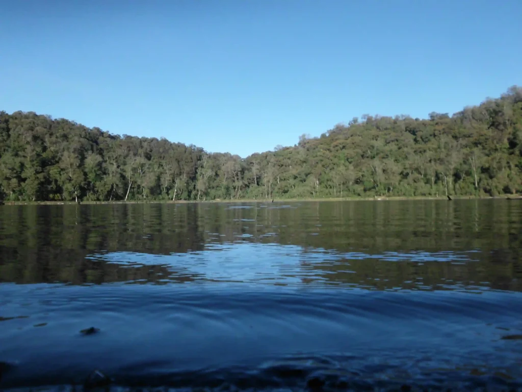
Dark green, still, surrounded by crater walls covered in cloud forest right up to the rim. A sight to behold, we can assure you. When you walk down the steps and the lagoon comes into view for the first time, the effect is incredible. The mist comes and goes in a matter of seconds: one moment the water clearly reflects the vegetation on the walls; the next, everything vanishes into the mist. On the shore there are altars with the remains of candles, flowers and copal. Do not touch them.
The constant flow of mist in and out of the crater contributes to an atmosphere that visitors themselves describe as unique: a place that changes its appearance every few minutes.
Dimensions and characteristics of the lake
- Approximate diameter: 500 metres
- Estimated depth: between 30 and 60 metres
- Altitude: approximately 2,712 metres above sea level
- Water temperature: cold all year round
- Colour: dark green, with shades that vary depending on the light and the mist
A footpath runs along the rim of the crater, allowing visitors to walk all the way round it. The circular walk takes between 45 minutes and 1 hour.
Why is it considered a sacred lake?
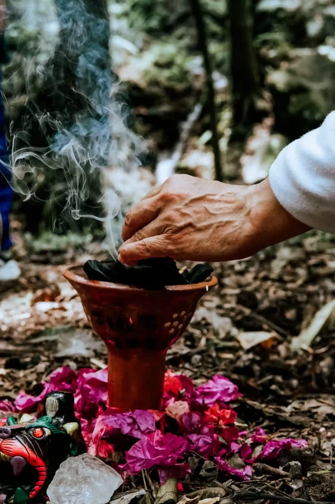
For the Mam communities, the water in the lagoon is not a natural resource: it's an entity with a life of its own. According to their worldview, the lords of water and wind dwell in its depths, and its waters connect the physical world with the spiritual. Swimming is forbidden, not because of a tourist regulation, but because of what it implies. The same applies to littering or making noise. You are in a place of active worship: the atmosphere makes this quite clear without the need for signs.
- This page about Zaculeu may interest you.
The spiritual significance of Chicabal Lagoon
The Mam Maya worldview
The Mam people have a strong presence in the department of Quetzaltenango and in part of Huehuetenango. In their understanding of the world, nature and spirituality are inseparable: the hills, volcanoes, rivers and lakes are beings with their own energy, not merely decorative landscapes. Chicabal and its lake lie at the heart of this sacred landscape. For those who view it through this lens, the lake is not merely water: it's a point of connection.
Ancient ceremonies and rituals
Ceremonies at the lagoon are held throughout the year, but the most intense moments coincide with the Mayan Tzolkin calendar, particularly around 40 days after the Catholic Holy Week – which does not coincide with the Mayan Holy Week – when groups of pilgrims from different communities arrive to spend the night on the shore, light fires, sing and make offerings. The rituals are dedicated to the God of the World and are led by Mayan priests and priestesses who use fire as a central element, alongside copal, coloured candles and flowers.
During this period, access may be restricted for foreign visitors. If you’re planning to visit in May, please check before you arrive.
Rules and respect during your visit
- Do not swim in the lagoon. It's forbidden and constitutes a serious lack of respect towards the local communities.
- Do not touch or move any altars or offerings you find on the riverbank.
- Turn the volume down. The lake is a place for quiet reflection.
- Don’t leave any rubbish behind. Take everything you brought up back down with you.
- Ask before taking photographs near the altars or if any ceremonies are taking place.
- Please follow the instructions given by the local guide or community staff at the entrance.
How to climb Chicabal Volcano
Most popular ascent route
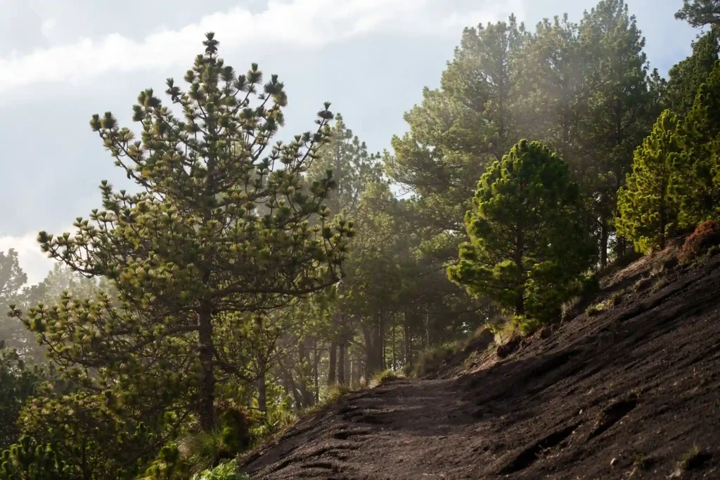
The main trail starts at the car park, next to the visitor centre, and climbs along a well-marked path through the pine and cypress forest to the viewpoint. From there, a wooden staircase leads down to the shore of the lagoon. The route is circular: you can climb up on one side, walk round the lagoon along the path inside the crater, and return via the other side. The path is in good condition for the most part and is well signposted. There are no technical sections or climbing sections.
Duration and level of difficulty
- Total distance: 4.63 km (round trip)
- Elevation gain: 328 m
- Difficulty: easy to moderate
- Time from the car park to the lake: 35–45 minutes
- Full circuit, including the loop around the lagoon: 2.5 to 3 hours
This route is accessible to most people of average fitness. No previous hiking experience is required, although the ground may be slippery if it has rained.
What to expect during the walk
The ascent takes you through a dense forest that keeps the temperature cool at all times. The sound of birdsong is constant. As you approach the rim of the crater, the vegetation changes: a denser cloud forest appears, with moss covering the tree trunks and ferns on the ground. Leaning over the rim to catch a sudden glimpse of the lake is one of the highlights of the walk. Next comes the descent down the steps, which may be damp in places.
The path to Chicabal Lagoon
Viewpoints and scenery along the route
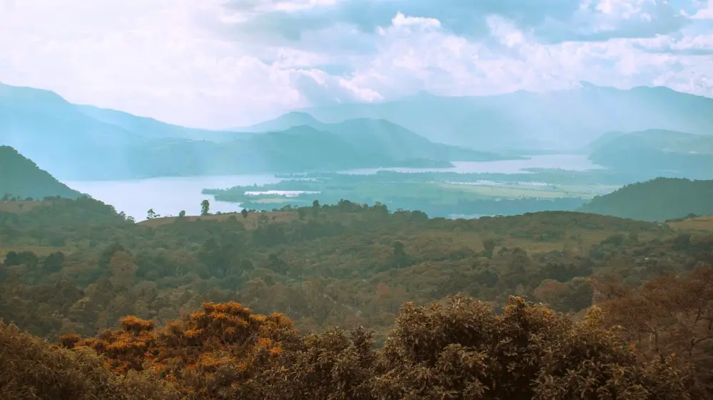
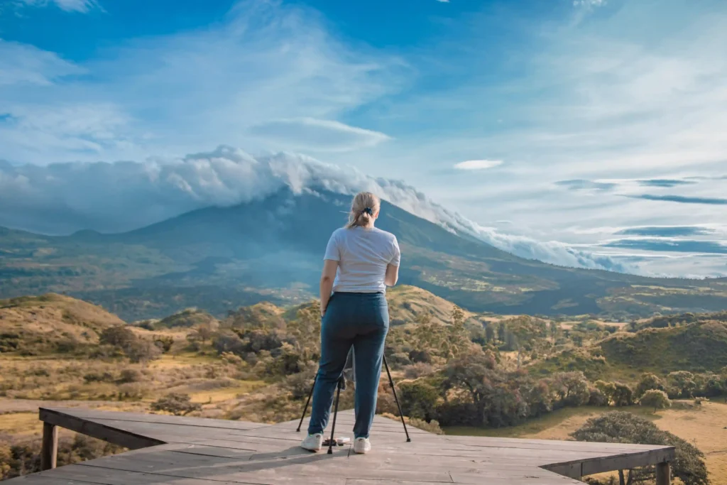
On the way to the crater, there are several vantage points offering views of the Quetzaltenango highlands and, on clear days, of the Santa María Volcano and other peaks in the region. These are good places to stop for a breather before reaching the lake. From the crater’s rim, when the mist allows, the view of the lake and the surrounding forest is the most photographed sight in the area.
The famous staircase leading up to the crater
One of the most recognisable features of the trail is the wooden staircase that leads down from the viewpoint to the shore of the lagoon. It has around 500 steps and descends steeply down the inner wall of the crater. This is the section that features most in photos and also the one that requires the most care on the way down: when it is wet, it's best to descend slowly.
- We invite you to read our article about Laguna de Calderas.
Best time to visit the Chicabal volcano
Climate throughout the year
Chicabal has a cloud forest microclimate all year round: cool, humid and frequently foggy. Temperatures at the lagoon rarely exceed 15 °C and can drop considerably in the wind. Always take warm clothes with you, even if it’s sunny when you set off from Xela. And a practical tip: don’t wear jeans – they absorb moisture and, with the cold in the crater, you’ll have a rough time of it.
Dry season and rainy season
The dry season, from November to April, offers a better chance of finding the lagoon clear, at least during the early hours of the morning. During the wet season, from May to October, the mist is almost constant and the path becomes more slippery. That said, some people prefer to visit during the wet season precisely because of that more atmospheric setting. It depends on what you’re looking for.
When to enjoy the best views of the lagoon
The best time to visit the lagoon is in the early morning, before 10:00 am, when the skies are usually clear. The mist rises from the valleys as the day progresses. If you arrive in the afternoon, you’re likely to find the crater shrouded in mist.
How to include Chicabal in a tour of Quetzaltenango
Chicabal is a straightforward day trip from Xela. You can combine it with a morning in the historic centre of Quetzaltenango – the Quetzaltenango Municipal Theatre, the market or the Parque Centroamérica – to round off the day with a mix of nature and city life.
If you’re spending a few days in the region, a good itinerary is: Cerro El Baúl on the first day to acclimatise, Chicabal on the second to see the lake and the cloud forest, and Cerro Quemado or Santa María Volcano to round off with the most challenging climb in the area. And if you want to delve deeper into the local culture, don’t leave Xela without seeing the traditional costume of Quetzaltenango.
Frequently Asked Questions about the Chicabal volcano
How do you get to Chicabal Lagoon?
From Quetzaltenango, take a minibus to San Marcos and then catch local transport to San Martín Sacatepéquez. By car or taxi, it’s about 28 km from Xela, taking approximately 45–60 minutes. The tarmac road ends at the hamlet of Toj Mech; from there, it’s 3 km along a steep dirt track, which you can cover on foot or in the local pick-up truck known as ‘el Torito’. At the entrance there is a community checkpoint, where you pay the fee (Q15) and can hire a local guide.
How long does the walk to the lake take?
From the car park to the shore of the lagoon, between 35 and 45 minutes. The full circuit, which includes the path that goes round the lagoon inside the crater, takes between 2.5 and 3 hours. Easy to moderate difficulty; no technical mountaineering experience is required.
Why is Chicabal Lagoon a sacred place?
For the Mam and Quiché Mayan communities, the lagoon is the dwelling place of the lords of the water and a point of connection between the physical and spiritual worlds. Ceremonies following the Mayan calendar are held on its shores throughout the year, with the most intense celebrations taking place around 40 days after Easter. It's one of the most important sites of active worship in Guatemala. Visiting it with respect is not optional: it's what the place demands.