Guatemala is a country criss-crossed by water. And hidden within each of its river basins lies a little piece of history. From the highland mountains to the jungles of Petén and the Caribbean and Pacific coasts, Guatemala’s rivers shape a landscape that connects ecosystems and communities. To understand this is to get closer to the very essence of this land.
What are Guatemala’s rivers?
Definition and general characteristics
Guatemala’s rivers are freshwater courses that mainly originate in the mountainous regions of the highlands and in volcanic ranges, fed by seasonal rainfall and natural springs.
Many of them are short in length but have steep gradients, which result in fast-flowing currents and variable water levels depending on the time of year. Among the most important are the Motagua River, the country’s longest, and the Usumacinta River, the river with the highest flow rate.
Ecological and cultural significance
This river network fulfils a very special function: the conservation of the ecosystem. By supplying water to forests, wetlands and agricultural areas, these rivers form biological corridors that enable numerous species of flora and fauna to survive.
From a cultural perspective, many rivers in Guatemala are linked to the Mayan worldview and to the history of pre-colonial peoples who regarded them as sources of life associated with fertility.
How they influence the lives of communities
Guatemala’s rivers are a source of drinking water for local communities and also support the development of agriculture and fisheries. Today, they remain essential to the rural economy, which is why their conservation and sustainable management are becoming increasingly important.
- This page about the natural wonders of Guatemala may interest you.
Major rivers of Guatemala
Motagua River
The Motagua River is the longest in Guatemala, stretching for around 486 km, and flows through much of the country from the highlands to the Caribbean Sea. It rises in the department of Quiché and flows through several regions of Guatemala before reaching the Atlantic coast.
Furthermore, it remains vital for agriculture, the water supply and the economy of the communities in its catchment area.
Polochic River
The Polochic River flows through the valley of the same name in Alta and Baja Verapaz, until it reaches Lake Izabal, where it forms an extensive wetland system. It is one of the most important rivers in Guatemala’s Caribbean region due to its ecological richness, as its catchment area is home to rainforests and endemic species.
Historically, it has served as a link between the highlands and the Verapaces region, fostering trade and cultural exchange amongst the Q’eqchi’ communities. Guatemala holds this river so dear that a marimba song bearing its name was even composed.
Usumacinta River
The Usumacinta, a historic hub of the ancient Mayan trade routes, is considered the river with the highest flow in Guatemala and forms part of the natural border between Guatemala and Mexico.
Its river system is fed by major tributaries from the north of the country, such as the La Pasión River, and flows through one of the most significant regions of the Mayan world. Along its catchment area lie important archaeological sites surrounded by tropical rainforest, including Piedras Negras and other historic sites in the Petén.
Cahabón River
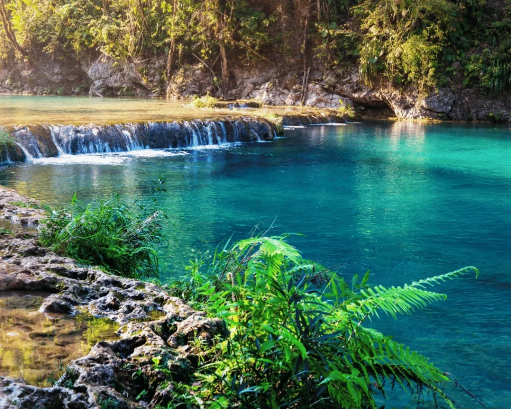
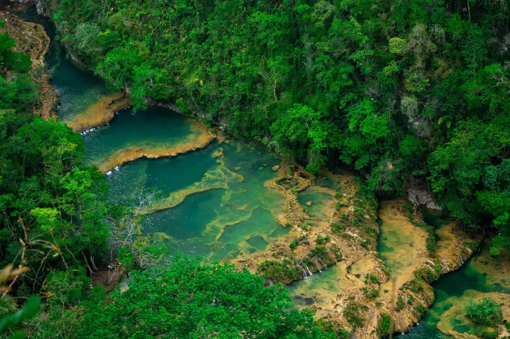
The Cahabón River, situated in Alta Verapaz, is famous for its turquoise waters and jungle landscapes. Its waters eventually flow into the Polochic river system, which empties into Lake Izabal. Its banks have been chosen as sites for numerous settlements since the time of the Maya.
Río Dulce
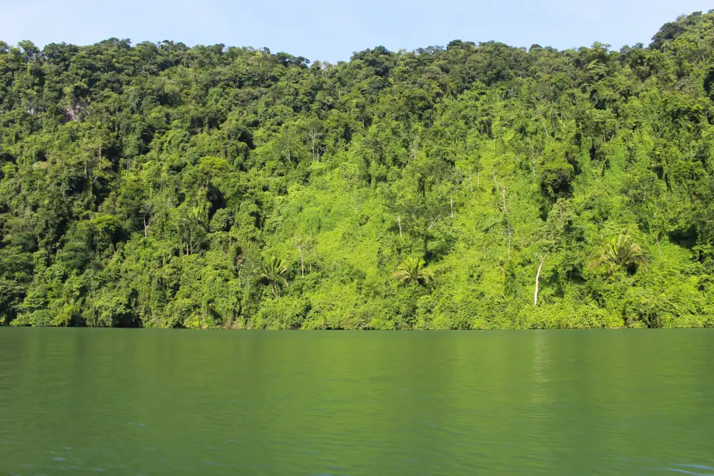
The Río Dulce connects Lake Izabal with Amatique Bay and the Caribbean Sea. Along its course, it flows through canyons covered in tropical rainforest, mangroves and protected areas such as the Río Dulce National Park, which has been protected since 1955. It is also an important refuge for species such as the West Indian manatee.
Other major rivers in the country
As well as its major river systems, Guatemala has numerous rivers of great regional importance. For example, the Samalá River in Quetzaltenango, the Suchiate River, which forms the border with Mexico, and the Paz River, which forms part of the border with El Salvador.
- We invite you to read our article about Río Azul.
Location and course of the rivers
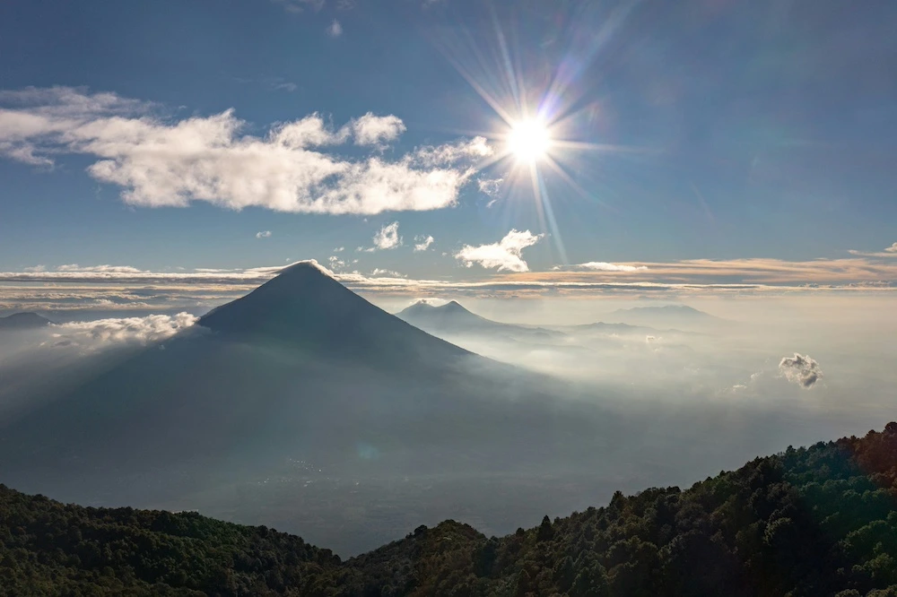
Guatemala’s river network is strongly shaped by its volcanic and mountainous geography. As a result, many of these rivers rise in the central highlands and flow down steep slopes towards the Caribbean or the Pacific.
Connections to lakes, lagoons and seas
Many of Guatemala’s rivers act as links connecting the country’s key ecosystems. The Dulce River, for example, connects Lake Izabal with the Caribbean Sea, creating one of the most important biological corridors in Central America.
In Petén, the Usumacinta system includes lakes such as Petén Itzá and Yaxhá, whilst in the highlands numerous rivers feed small lakes and agricultural irrigation systems.
History and culture linked to Guatemala’s rivers
Since pre-Hispanic times, Guatemala’s rivers have been the true cornerstones of civilisation in the country. The ancient Mayan cities were built near water sources such as the Usumacinta and its tributaries, which enabled intensive agriculture, trade and communication between regions.
In many cases, rivers also formed natural boundaries between Mayan city-states, serving as political borders and trade routes for goods such as jade, cocoa and obsidian.
Historical significance for Mayan communities
As well as being natural resources that helped communities to thrive and communicate, the Maya also regarded them as living entities with spiritual significance.
Freshwater was associated with fertility, creation and the continuity of life, which is why many settlements were organised around river basins such as those of the Usumacinta and the Motagua.
Legends and traditions associated with Guatemala’s rivers
In the Guatemalan folk worldview, rivers hold deep symbolic and spiritual significance. Many indigenous traditions regard certain features of the landscape, such as mountains, caves, springs and watercourses, as possessing a sacred dimension.
Among the Q’eqchi’ peoples, for example, the figure of the Tzultaq’a stands out: a spiritual entity linked to the mountains and nature that occupies a central place in the region’s traditional beliefs.
Among the best-known characters in Guatemalan folklore is the Sisimite, a legendary figure found in various regions of the country and traditionally associated with forests, mountains and remote natural areas. Although accounts vary from one community to another, this creature forms part of the folk tales that have been part of life in rural and jungle settings for generations.
Things to do and see along the Rivers of Guatemala
Leisure activities and water sports
In Guatemala, rivers such as the Cahabón are ideal for activities such as tubing and kayaking, particularly in areas near Semuc Champey, where the jungle setting adds a touch of magic. The Río Dulce also offers kayaking trips and boat tours through mangroves and tropical gorges.
Excursions and river cruises
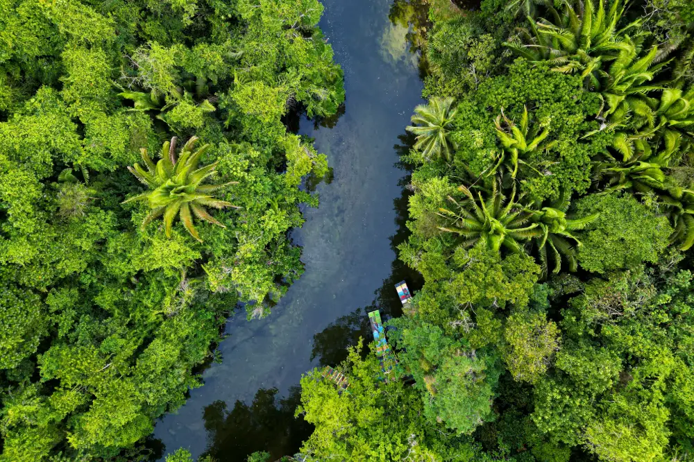
If you enjoy exploring, there are several rivers in Guatemala that invite you to do so. The Río Dulce is the most iconic example, offering boat trips through jungle canyons, past riverside communities and on to Lake Izabal. In the Petén, certain stretches of the Usumacinta river system can also be explored by boat to reach Mayan archaeological sites hidden in the jungle.
Wildlife spotting
Guatemala’s rivers flow through highly diverse ecosystems that are home to a wealth of biodiversity. The Río Dulce, one of the most iconic, is notable for its population of West Indian manatees, as well as the mangroves and rainforests along its banks. On the Polochic River, the wetlands are home to a wide variety of waterbirds such as herons and cormorants, alongside the dense tropical vegetation typical of the Verapaz Valley.
Nature photography
If you’re travelling to Guatemala, don’t miss the chance to capture the sunrise whilst cruising down the Río Dulce or the golden light filtering through the jungle of Cahabón. The Río Dulce canyon, the famous turquoise pools of Semuc Champey on the Cahabón River… let yourself be carried along by Guatemala’s currents and you’ll end up with a memory card full of photos by the end of your trip.
- We invite you to read our article about the Motagua River.
Best time to visit Guatemala’s rivers
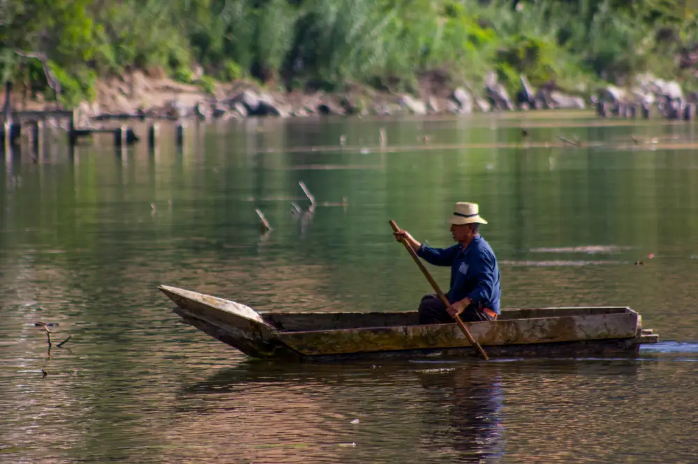
The best time to enjoy Guatemala’s rivers depends largely on the country’s tropical climate. This is mainly divided into the dry season (November to April) and the rainy season (May to October).
Water levels and safety
- Dry season (November–April): river levels are lower and more manageable, making this the ideal time for water-based activities.
- Rainy season (May–October): water levels can rise rapidly, particularly in mountain rivers such as the Samalá and the Motagua.
- Safety during activities: it is always advisable to take part in water sports with local guides, as they know the safe spots and how the water flow changes depending on the season.
- Weather conditions: heavy rain can cause dangerous currents and reduced visibility, so it is advisable to avoid water-based activities during storms or on days of heavy rain.
Tips for exploring Guatemala’s rivers
Exploring Guatemala’s rivers is an experience that combines unspoilt nature, local culture and adventure, but it also requires preparation. Many of these rivers flow through areas of jungle, mountains or gorges with limited access.
Safety recommendations
- Always hire local guides on navigable or adventure rivers.
- Avoid water-based activities during heavy rain.
- Wear a life jacket when kayaking, tubing or going on boat trips.
- Check the river conditions before you visit.
- Don’t stray from signposted areas or tourist spots.
- Wear suitable footwear and avoid swimming in unfamiliar areas.
How to respect the environment and local wildlife
Exploring Guatemala’s rivers also means looking after very fragile ecosystems of great biological value. Please do not leave any rubbish behind; always take your waste away with you, especially plastic, and keep your distance from wildlife so as not to disturb their natural behaviour.
Furthermore, it works with responsible tour operators who comply with environmental regulations and contribute to the conservation of these unique areas.
What to see near the main rivers
Exploring the areas surrounding Guatemala’s major rivers provides a better understanding of how water has shaped the country’s history, economy and everyday life.
Riverside towns and villages
Many Guatemalan rivers are linked to communities with their own distinct identities. On the banks of the Río Dulce lies Livingston, a Caribbean town with a strong Garifuna influence and direct access to the sea. In the east, the Motagua River flows through areas such as Zacapa and farming communities where the river has been key to local development.
In the highlands, small villages near the River Samalá or the River Paz still have traditional markets and a rural way of life characterised by the use of water for irrigation and agriculture.
National parks and nature reserves
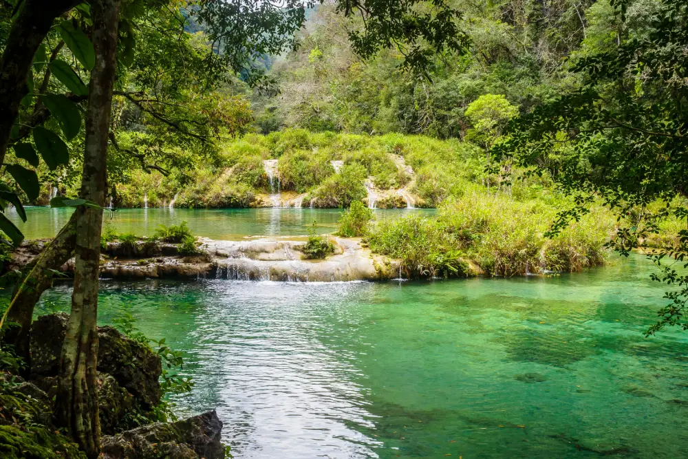
Many of Guatemala’s major rivers are protected within nature reserves. The Río Dulce forms part of the Río Dulce National Park, a corridor of tropical rainforest and mangroves that connects Lake Izabal with the Caribbean.
In Alta Verapaz, the area around the Cahabón River is surrounded by nature reserves and sites such as Semuc Champey. In Petén, the Usumacinta river system flows through protected areas such as the Maya Biosphere Reserve, home to a wealth of biodiversity and Mayan archaeological sites.
Indigenous and cultural communities
Guatemala’s river basins are deeply intertwined with the indigenous communities that have historically lived alongside the rivers. In the Verapaces region, Q’eqchi’ communities depend on the Cahabón and Polochic rivers for agriculture and their daily lives, maintaining traditions linked to water.
In the highlands, K’iche’ and Kaqchikel communities have developed agricultural systems centred on rivers such as the Samalá. In the north of the country, Mayan communities in the Petén maintain a spiritual connection with the rivers of the Usumacinta, which are considered an essential part of their cultural identity and worldview.
Frequently Asked Questions about Guatemala’s rivers
What are the main rivers in Guatemala?
Among the country’s most important rivers are the Motagua, Guatemala’s longest, and the Usumacinta, the river with the greatest flow. Also of significance is the Río Dulce, which connects Lake Izabal with the Caribbean, and the Cahabón River, famous for Semuc Champey. Finally, the Polochic River is vital to the wetlands of the Izabal region.
Where are the country’s most important rivers located?
Guatemala’s main rivers are distributed according to the country’s geography:
- In the north (Petén) there are river systems such as the Usumacinta.
- In the east, the Motagua River flows through several regions on its way to the Caribbean.
- In the Verapaces, the Cahabón and the Polochic rivers wind their way through jungles and mountains.
- In the south, rivers such as the Samalá and the Paz flow into the Pacific Ocean.
When is the best time to visit the rivers in Guatemala?
The best time to visit is usually the dry season (November to April), when river levels are more stable and it is safer to take part in activities such as kayaking, hiking or boating.