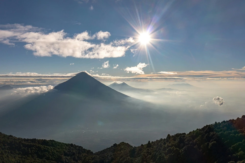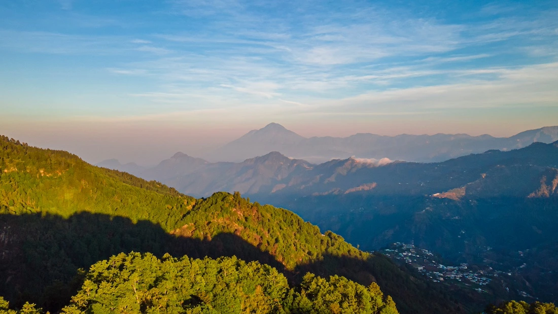
Situated on the border between Guatemala and Mexico, the Tacaná Volcano dominates much of the landscape of the department of San Marcos and offers some of the most spectacular views of the western highlands.
Far from the country’s best-known routes, this colossus offers hiking, nature and local culture in a setting where mountain forests, rural communities and stunning views combine to create an experience you’ll find hard to forget. If you’re looking to discover a less-travelled and more authentic side of Guatemala, this mountain deserves a place on your itinerary.
What is the Tacaná Volcano?
Geographical features of the volcano
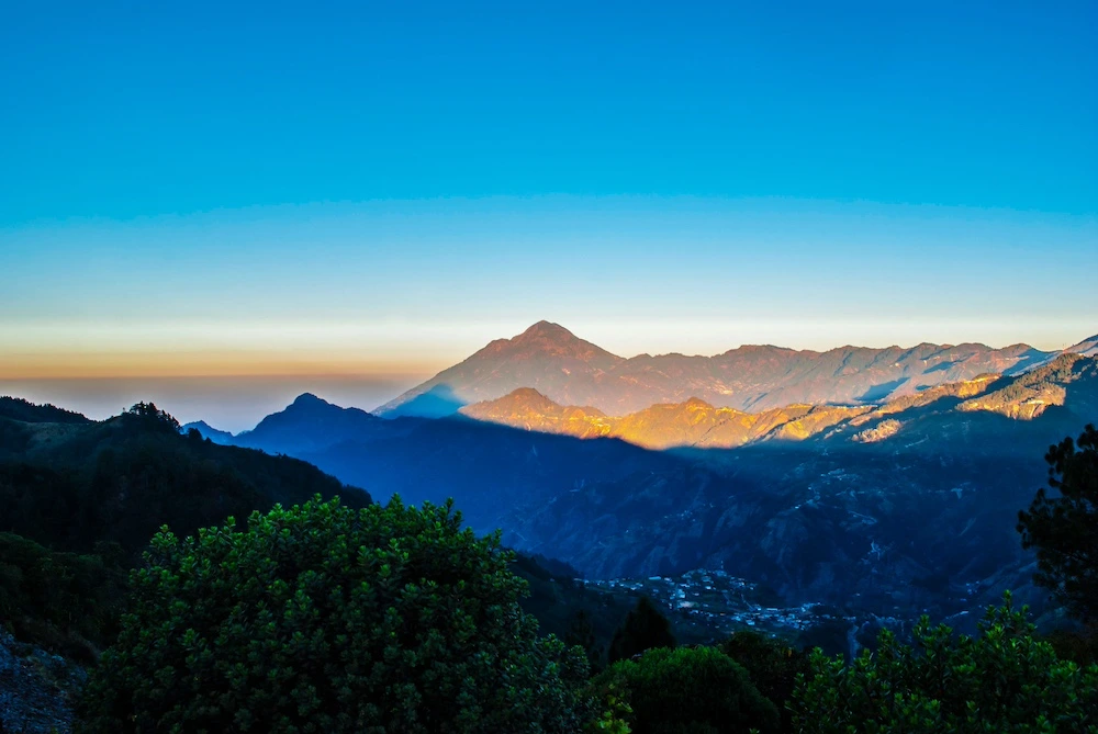
The Tacaná Volcano is a large mountain of volcanic origin situated in the far west of Guatemala. Its massif stretches on both sides of the border between Guatemala and Mexico, forming part of the volcanic range that runs through Central America.
This impressive natural monument is an active stratovolcano that forms part of the majestic Sierra Madre de Chiapas mountain range.

Altitude and significance in Guatemala
At 4,092 metres above sea level, the Tacaná Volcano is the second-highest peak in Guatemala and the eighth-highest in Mexico. Its silhouette dominates much of the horizon in this border region and is one of the department’s most recognisable landmarks.
Thanks to its altitude, from the highest points it's possible to enjoy sweeping views over parts of Guatemala and Mexico when weather conditions are favourable.
Why it’s a top destination in San Marcos
Although it tends to attract fewer visitors than other Guatemalan volcanoes, Tacaná Volcano offers a particularly appealing experience for those seeking nature and tranquillity.
For Central American mountaineers, it represents one of the most coveted achievements due to the demanding nature of its trails, combined with the sense of isolation amidst the natural world. Unlike the commercial peaks in the south, here one can experience an authentic alpine atmosphere, far removed from mass tourism.
Location of the Tacaná Volcano
Where is it located in San Marcos, Guatemala?
The Tacaná Volcano is situated in the department of San Marcos, in the far west of Guatemala. Its base and eastern slopes lie within the municipalities of Tacaná and Sibinal, right in the heart of the mountainous region. The main access route for mountaineers is usually via the small farming villages of Sibinal.
How to get there from the departmental capital
The town of San Marcos is usually one of the most common starting points for a visit to the Tacaná Volcano. Head north and take the road that climbs steeply towards the municipalities in the highlands, passing through Ixchiguán. When you reach the main junction, continue along a winding secondary road to the town centre of Sibinal. The journey by car takes about three hours.
Access routes from other parts of the western highlands
It's also possible to reach the area around the volcano from other towns in the western highlands. Many travellers combine their visit with trips to destinations such as Quetzaltenango or Huehuetenango. There is a route linking the north of San Marcos with the south of Huehuetenango via country roads.
Some international mountaineers also choose to approach via the authorised routes on the Chiapas side, in Mexico.
History and Geology of the Tacaná Volcano
Volcanic formation and volcanic activity
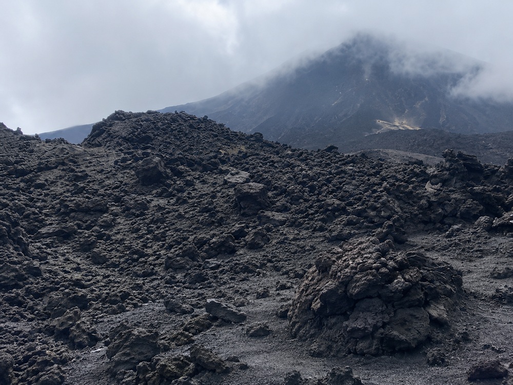
The Tacaná Volcano was formed as a result of the geological processes that gave rise to much of the Central American volcanic chain. Its existence is linked to the tectonic activity that has shaped the region’s landscape over millions of years.
At present, the volcano is known primarily for its scenic and natural value, rather than for any volcanic activity visible to visitors. The volcano has recorded minor phreatic eruptions, characterised mainly by the ejection of ash and water vapour.
Relations with local communities
The families of Mam Maya origin who live near the colossus regard the mountain as a living, protective being. For generations, they have learnt to grow potatoes and maize, adapting to the harsh, cold climate.
At present, the organised communities of Sibinal act as the legitimate administrators of the guide and accommodation services.
Ecological and cultural significance
The volcano is a critical biological refuge, designated a Biosphere Reserve in 2003, which safeguards the cloud forest ecosystem. Its dense forests act like sponges, capturing moisture and supplying water to the entire region. It's a vital habitat for the survival of endemic high-altitude plant species.
Culturally, it's home to ancient ceremonial sites where Mayan priests perform traditional fire ceremonies of thanksgiving and supplication known as Chucul.
Hiking on the Tacaná Volcano
Routes and difficulty levels
The routes for exploring the Tacaná Volcano offer varying levels of difficulty. The most famous and safest route is the one that starts in the village of Hacienda in Sibinal. The hike takes between 4 and 6 hours and the difficulty ranges from moderate to high due to the constant elevation gain. There is another, technically more demanding alternative route known as ‘La Línea’, which runs along the border, and the ascent takes between 6 and 8 hours. It's undoubtedly a sporting challenge.
What to expect during the climb
The climb allows you to see how the landscape gradually changes with altitude. The mountain forests give way to more open areas, from which increasingly sweeping views of the surroundings begin to appear, although it's quite cloudy. The final stretch follows footpaths of loose volcanic sand and boulders near the craters. It’s physically demanding, but the reward keeps you motivated.
Rest areas and natural viewpoints
The route features specific spots that are ideal for regaining your strength, such as the Laguna Seca section. This sandy area serves as a campsite sheltered from the icy afternoon wind and is less than an hour from the main summit.
Along the way, you’ll also come across natural vantage points offering spectacular views of the San Marcos valleys.
What to see at the Tacaná Volcano
Panoramic landscapes and mountain peaks
The panoramic views are one of the main reasons to visit Tacaná Volcano. Reaching the summit allows you to stand exactly on the international border that divides the two nations. From the summit, the panoramic view takes in the vast expanse of the Sierra Madre and the Pacific coastal plain. On clear days, you might be lucky enough to catch a glimpse of the neighbouring Tajumulco Volcano on the horizon, like something out of a postcard.
Flora and fauna of the area
The mountain forests surrounding the volcano are home to a wide variety of species, thanks to the humidity and variations in altitude, which foster the development of some very interesting ecosystems. There are forests of pine and alpine fir, as well as dense mosses, lichens and wildflowers. It's an ecosystem adapted to the extreme frosts found at high altitudes.
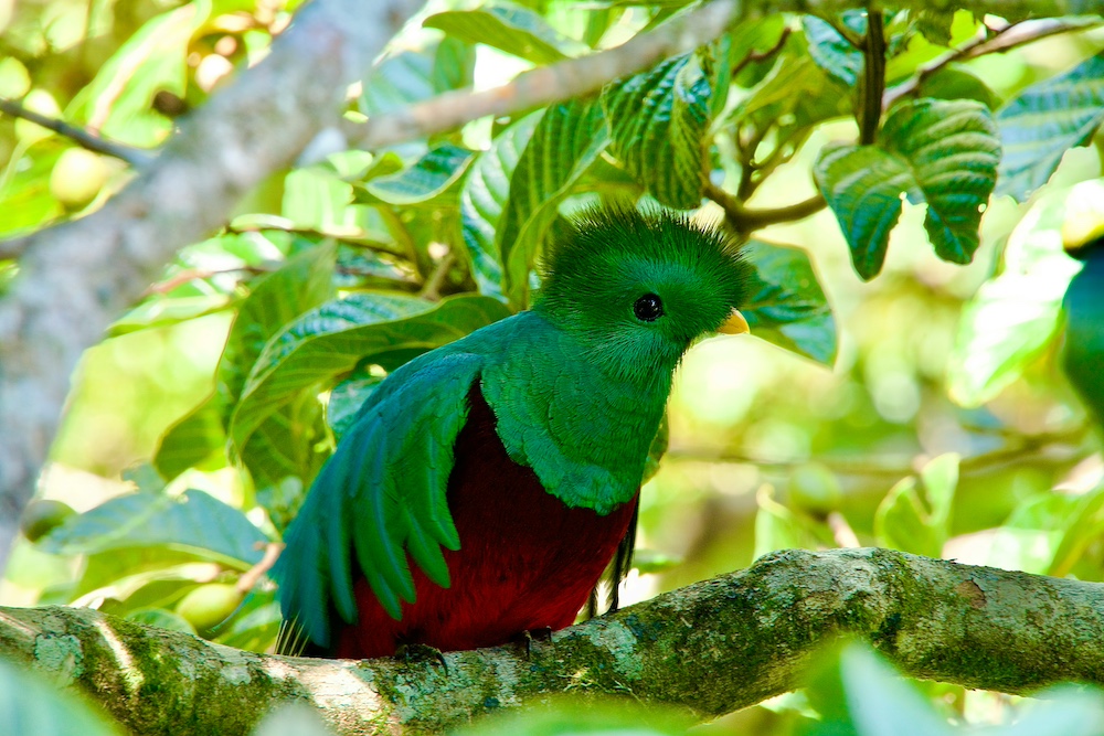
As for wildlife, the area is home to the quetzal and the pavón, a rare, endangered endemic bird.
Nearby waterfalls and rivers
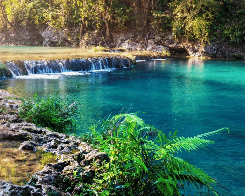
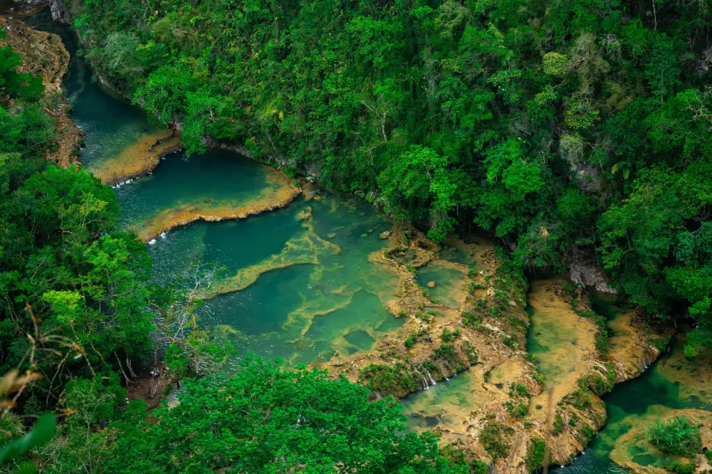
The area surrounding the Tacaná Volcano forms part of a region where springs and small streams abound, flowing down towards the low-lying valleys of Sibinal. These streams are responsible for the fertility of the agricultural land at the foot of the volcano.
Villages and communities around the volcano
The area surrounding the volcano retains a distinctly rural character. The small villages offer an authentic glimpse of life on the high plateau. Their traditional adobe houses and steep terraced fields demonstrate humanity’s ingenious adaptation to the mountainous terrain.
Tacaná San Marcos: Culture and traditions
History of the neighbouring communities
The human settlements in the vicinity of the mountain have deep pre-Hispanic roots, closely linked to the great Mam dynasty. These Mesoamerican peoples used the highlands as strategic refuges and as areas for hunting and gathering medicinal plants. The 19th-century demarcation of the border divided some families, but traditional cultural and commercial ties remained intact.
Local festivals and customs
Religious and community celebrations continue to play a significant role in many municipalities in San Marcos. Local traditions are displayed in a highly colourful manner during the patron saint festivals in the municipalities of Sibinal and Tacaná. The celebrations include ancient folk dances, traditional music played on wooden marimbas and religious ceremonies. The rural streets are decorated with carpets of sawdust and wild mountain flowers.
Interaction with visitors and local guides
Many travellers choose to explore Tacaná Volcano accompanied by people who know the area well, in order to gain a better understanding of the natural and cultural environment during their visit. The Sibinal community tourism office coordinates the allocation of local guides authorised to lead the ascent.
- This page about the natural wonders in Guatemala may interest you.
Best time to climb Tacaná Volcano
Dry season and rainy season
The dry season, from November to April, generally offers better conditions for walking and enjoying the views. During these months, clear skies are more common and the trails are in better condition, with no risk of sudden thunderstorms. The rainy season, on the other hand, transforms the landscape, but the ground is often slippery.
Ideal conditions for hiking
To enjoy glorious mornings with horizons completely clear of clouds, it's recommended that you make the ascent between December and February. However, bear in mind that these months see the coldest winds of the year.
Travelling at this time of year ensures that the terrain along the Hacienda Sibinal route is firm and safe for walking. Furthermore, the camping conditions in the Laguna Seca area are ideal for enjoying perfect, starry skies free from humidity.
Recommended times for safe ascents
Hikers prefer to set off first thing in the morning to make the most of the hours when the weather is most stable and to have more time to complete the route. This ensures you’ll reach the upper campsite whilst it’s still light enough to pitch your tents.
By the end of the summit climb, groups usually wake up at four in the morning the following day. Ideally, you should walk at night with torches so that you can reach the summit just in time to see the first rays of the sunrise.
Tips for visiting the Tacaná Volcano
What to pack for the walk
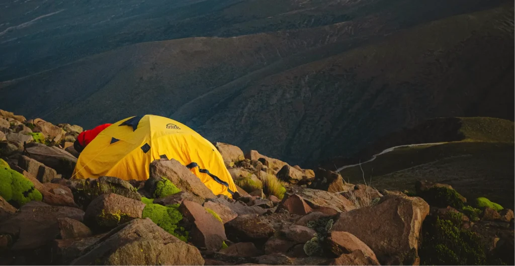
It's essential to wear thermal layers, including a waterproof jacket, a mountain windbreaker and warm gloves. It's best to wear high-top hiking boots with good grip to protect your ankles from loose stones on the trail. For sleeping, take a three-season tent, a sleeping bag suitable for sub-zero temperatures and a thermal mat.
Make sure you take plenty of clean water, water purification tablets and high-calorie, quick-to-prepare food, such as nuts, chocolate and hot soups. Don’t forget your head torch with spare batteries, sun cream and a basic personal first-aid kit.
Safety and acclimatisation recommendations
Altitude can make physical exertion more demanding than usual. It's therefore advisable to maintain a suitable pace and pay attention to how you feel whilst walking. Never try to break away from your group or stray from the paths officially marked by the guides.
If weather conditions deteriorate drastically near the summit, always prioritise your physical safety and begin a precautionary descent. The mountain demands caution and respect.
How to plan a day trip or longer trip
The most recommended itinerary is a two-day, one-night trip. You spend the first day driving up the road, registering with the local community and walking to the mountain camp. The second day is for reaching the summit at dawn and completing the descent. Doing it all in a single day requires a level of physical fitness that few people possess, as well as plenty of time.
What to see near the Tacaná Volcano
San Marcos and the surrounding area
The department of San Marcos has a peaceful urban atmosphere, and nearby you can visit the beautiful Franja Transversal valley and the coffee plantations that dot the lower slopes.
Cuchumatanes Mountains
The Sierra de los Cuchumatanes is home to some of Guatemala’s most spectacular high-mountain landscapes. Its vast expanses and remote location make it one of the major attractions in the west of the country.
Other nearby volcanoes
Western Guatemala is home to several of the country’s most significant volcanoes, such as the Tajumulco Volcano, the highest peak in the whole of Central America.
Indigenous peoples and the landscapes of the Altiplano
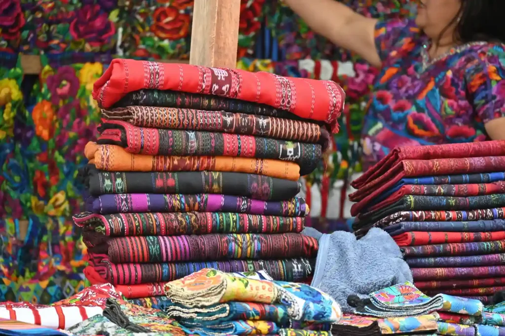
The villages of the western highlands have preserved many of their cultural traditions and are an essential part of any trip to the region. Towns such as Ixchiguán and Tejutla reveal the very essence of the Mam Maya communities. Their colourful weekly open-air markets are true hubs of cultural exchange, where fresh produce and woven handicrafts are sold.
The landscapes of the high plateau alternate between cold plains dotted with grazing sheep and pine forests shrouded in the usual mist.
- This page about the Las Verapaces Nature Reserve may interest you.
Is Tacaná Volcano worth a visit?
What makes the experience unique
What sets Tacaná Volcano apart is the sense of vastness offered by its surroundings. The opportunity to stand on the very summit of an international border and gaze out over two countries at the same time is unrivalled. What’s more, the sunrises over the Pacific’s sea of clouds from its summit are a truly spectacular sight.
Who is this visit recommended for?
Tacaná Volcano is an excellent choice for experienced hikers, photography enthusiasts and lovers of the great outdoors. It's also of interest to those wishing to discover a less touristy side of western Guatemala.
How to include it in an itinerary around San Marcos and Guatemala
You can organise an efficient 4-day itinerary. Set up your base in the departmental capital of San Marcos on the first day, and devote the second and third days entirely to the Tacaná Volcano expedition from Sibinal.
Spend the fourth day relaxing as you visit the traditional markets of the indigenous villages in the Sierra Madre highlands.
Frequently Asked Questions about the Tacaná Volcano
Where is the Tacaná Volcano located in Guatemala?
The Tacaná Volcano is situated in the far north of the department of San Marcos, on the border between Guatemala and Mexico.
How do I get to Tacaná San Marcos?
The most common way to get there is from towns in the department of San Marcos via roads that link up with the communities situated around the mountain. Drive north, following the tarmac road through the high mountain range that passes through Ixchiguán. When you reach the junction, take the secondary mountain road that leads directly to the town centre of Sibinal.
How difficult is the climb up the volcano?
The difficulty depends on the route chosen and each person’s fitness level. Some walks require considerable effort due to the altitude and the total elevation gain, but in general the difficulty is moderate to high.