The Santa María volcano is the fourth-highest volcano in Guatemala. At 3,772 metres, it was the site of an eruption in 1902 that changed the landscape forever, and the active Santiaguito volcano lies right at its feet. Climbing it's a full-day’s journey that demands well-trained legs. What you get in return is far too much to put into words.
If you’re in Xela, looking at the cone from the town and wondering whether it’s worth the effort: it is. In this guide, we’ll tell you exactly how to do it.
What is the Santa María volcano?
A stratovolcano with an almost symmetrical cone, visible from Quetzaltenango on clear days. It has dominated the skyline of Guatemala’s western highlands for over a century. In K’iche’, it's known as Gagxanul: ‘bare mountain’.
Characteristics of the Santa María volcano
Alternating layers of solidified lava and pyroclastic material, built up over thousands of years. On the western flank there is an explosion crater – the very same one that gave rise to Santiaguito in 1922. Until 1902, the cone was almost perfect, straight out of a textbook. The eruption shattered it and left that gap on the south-western flank that you can see today from above.

There are written records of its eruptions dating back to the Memorial of Sololá in the 16th century.
Altitude and geographical data
- Altitude: 3,772 metres above sea level
- Type: Stratovolcano
- Location: Llano del Pinal, 10 km south of Quetzaltenango, Panajunoj Valley (start of the shortest ascent route)
- Status: ‘inactive’, with ongoing activity at the adjacent Santiaguito
- Distance to Guatemala City: approximately 200 km
- Admission price: free
- Local guide contact details: +502 57700068 / info-xela@inguat.gob.gt
Why it is one of Guatemala’s most famous volcanoes
The 1902 eruption was one of the largest of the 20th century: a plume of smoke 30 km high, half a metre of ash over Quetzaltenango, and more than 5,000 deaths. From its summit, you can see the active crater of Santiaguito and the longest volcanic chain in Central America. And you can climb it without specialist high-altitude mountaineering equipment. Almost no other volcano in the world offers this combination.
Location of the Santa María volcano
In the municipality of Quetzaltenango, in the western highlands of Guatemala. The hamlet of Llano del Pinal – where, according to historical records, the famous Tecún Umán died on 18 February 1524 – is the starting point for the ascent. The route begins almost opposite the monument to the mountaineer El Club Cuervos.
How to get there from Quetzaltenango
The starting point is 10 km south of the centre of Xela:
- By minibus: from the terminus opposite the Temple of Minerva (San Marcos exit), take the bus to Llano del Pinal or Chicavioc. It costs 2 quetzales and takes about 20–25 minutes.
- By taxi or tuk-tuk: straight to the start of the trail, no fuss.
- By car: there is informal parking at Llano del Pinal.
If you’re planning to do the night-time climb, organise your transport the night before or stay overnight in the area – you’ll have one of the most memorable experiences!
Distance from other cities in Guatemala
- Guatemala City: 200 km, about 4 hours. Two possible routes:
- Via Tierra Fría, taking the CA-1 from Calzada Roosevelt, passing through Los Encuentros and Cuatro Caminos.
- Through Tierra Caliente, along the Palín–Escuintla motorway towards Mazatenango, and then north via Zunil to Quetzaltenango.
- Antigua Guatemala: about 3 hours.
- Huehuetenango: around 90 km, between 1.5 and 2 hours.
History and volcanic activity of Santa María
The great eruption of 1902
24 and 25 October 1902. The Santa María had not moved for centuries. What erupted that day was one of the largest eruptions of the 20th century: magmatic material hurled 8.6 kilometres away, a column of smoke rising 30 km into the air, and Quetzaltenango buried under half a metre of ash. It lasted nineteen days. More than 5,000 people died. The volcano never regained its former shape.
The crater it left on the western flank is still there. You can see it from the summit.
The formation of the Santiaguito volcanic complex
29 July 1922. Twenty years after the great eruption, the floor of the 1902 crater began to shift. What emerged was Santiaguito, Santa María’s safety valve, and it has not stopped since that day. It has been erupting continuously for over a century. Volcanologists from all over the world study it. You’re going to see it from above.
At night, with the volcano active, some travellers describe seeing the orange glow of the lava, with the lights of Xela in the background. On Tripadvisor, some people sum up the experience in a single word: ‘thrilling’.
Current volcanic activity in the area
Santa María has been dormant since 1902. Santiaguito, however, is not: it erupts roughly every hour. Before setting off, check the INSIVUMEH bulletins to find out the current situation in the area.
How to climb the Santa María volcano
Most popular climbing route
It starts at Llano del Pinal, almost opposite the monument to the mountaineer, and climbs straight to the summit via the northern flank. This is the most popular route and the best signposted in the lower sections. Approximate total distance: 4.91 km, with 1,208 metres of elevation gain, according to data from Wikiloc. The longest routes from Llano del Pinal are up to 11 km one way.
The first few kilometres take you through a well-marked pine forest. After that, the forest opens out, the terrain changes, and the final sections climb steeply over loose earth and volcanic rock up to the summit.
There is also an extended southern route starting from La Estancia de la Cruz: 20 km and 1,989 metres of elevation gain for those looking for a more challenging route.
Difficulty level of the walk
Difficult. Quetzaltrekkers, the go-to guide in Xela for this volcano, rates it at the highest level on its scale. The elevation gain from Llano del Pinal exceeds 1,200–1,300 metres over just a few kilometres. There is a sustained gradient in the middle sections, with loose ground in the upper reaches. No technical mountaineering experience is required, but you do need to be in good physical shape. This is not for beginners.
How long does it take to go up and down?
- Ascent: 3–4 hours at a brisk pace according to Guatevalley; up to 6 hours at a leisurely pace
- Descent: about 4 hours
- Total: between 7 and 10 hours
- Total distance: 10 km (6.2 miles) on the standard route
Most people set off at 5.00 am from Xela to reach the summit at dawn. A traveller on Tripadvisor reports setting off at 5.00 am with his family – including his 13-year-old son – and reaching the top at 10.00 am.
What to expect on the climb up Santa María volcano
Landscapes and ecosystems along the route
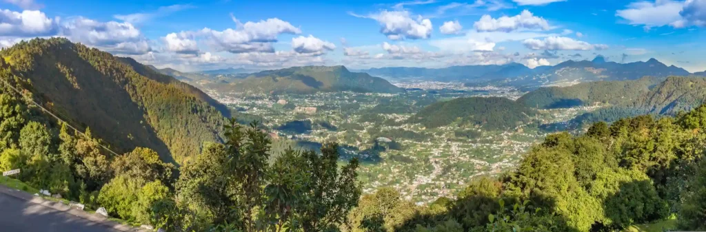
First, the farmland and maize fields of the communities in Llano del Pinal. Then, a dense pine forest that accompanies you for much of the climb. Further up, the forest gives way to volcanic terrain and the landscape suddenly opens up. You can feel that change both in your eyes and in your legs.
Changes in altitude and terrain conditions
You start at 2,520 metres and reach 3,772 metres. Your body really feels that difference in altitude, especially if you haven’t spent a few days acclimatising in Xela. Greater fatigue than usual, some shortness of breath, possibly a mild headache: these are normal symptoms of altitude, which can be managed by climbing slowly and drinking water regularly.
The loose soil on the upper sections is the most treacherous part of the route. It gives way on the ascent and becomes slippery on the descent. More than one review on Tripadvisor describes the descent as the toughest part of the day. That’s no exaggeration.
Tips for tackling the walk
- Set the pace right from the start. Starting too fast on the flat sections is the most common mistake. You’ll pay for it in the final metres.
- Salt water (4g per litre). At this altitude, the body loses fluid quickly and cramps can strike without warning.
- Trekking poles for the descent. Quetzaltrekkers hire them out at 20 quetzales per pole. On loose ground, your knees will thank you for it.
- Snacks every hour. Dried fruit, energy bars, sandwiches. Something quick that doesn’t mean we have to stop for too long.
- No canvas trousers. They absorb moisture and, at the summit, make you feel quite cold. Technical hiking clothing.
The views from the summit of the Santa María volcano
Panoramic view of Quetzaltenango
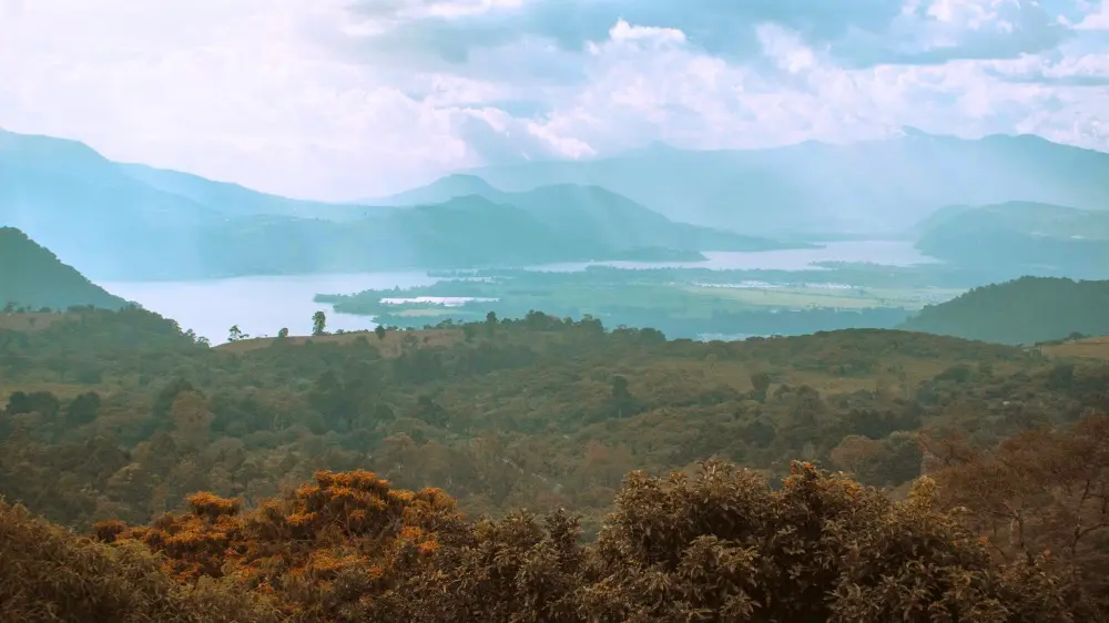
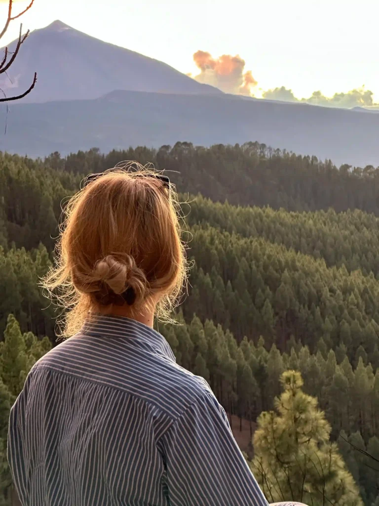
The whole of Xela in the valley. The Municipal Theatre of Quetzaltenango, the cathedral, El Baúl hill to the north and the highland municipalities surrounding the city. The farmland forms a mosaic of colours that doesn’t look quite the same when viewed from below. On clear days, the light stretches far and wide.
Views of the Santiaguito volcano and its eruptions
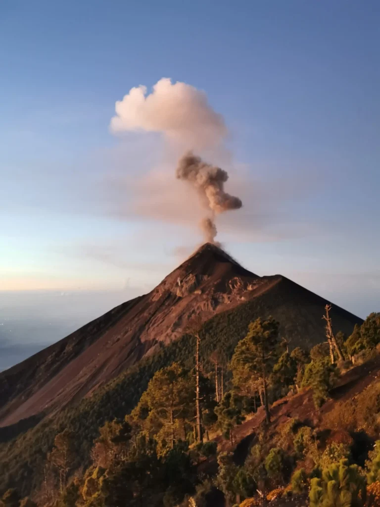
Just below, to the south-west, is Santiaguito. On active days, it spews columns of steam, ash and gases that you can watch rising from above in real time. At night, when activity is intense, some describe the orange glow of the lava against the backdrop of the city lights. It's one of the most breathtaking geological spectacles in Central America, and it lies right beneath your feet.
The volcanoes visible from the summit
On a clear day, the following can be seen: Cerro Quemado and the Siete Orejas near Xela; further away, Tacaná, Tajumulco, Chicabal and Lacandón; the volcanoes of Lake Atitlán – Atitlán, Tolimán, San Pedro –; and to the east, Acatenango, Fuego and Agua. Virtually the entire central chain of Central American volcanoes can be seen at a single glance.
Why this landscape is unique in Guatemala
A city, the highlands, an active volcanic range and an erupting volcano right beneath you. All at once, without moving from the summit. With no technical barriers to access. Some people spend months talking about it after they get back.
Best time to climb the Santa María volcano
Climate throughout the year
At the summit, at night, temperatures drop to between -7 and -11 degrees Celsius, even in the warmest months. During the day, on the descent, the sun beats down. It's this contrast that means you have to dress in layers: what you’re wearing at 3 am on the ascent won’t be suitable for 2 pm on the descent, and vice versa.
Dry season vs. rainy season
From November to April, the dry season: firm footpath, better visibility from the summit, minimal risk of thunderstorms. Thunderstorms are very common on this volcano and are the main reason not to climb it either when it's raining or during the height of the wet season.
During the rainy season, the ground becomes slippery and fog can roll in over the summit without warning. If you have no other choice, set off as early as possible and keep an eye on the sky.
Recommended kit for the walk
- Hiking boots with grippy soles. Unbeatable on volcanic terrain.
- Layered clothing: technical T-shirt, fleece, waterproof jacket. It will be cold at the top even if it’s warm at the bottom.
- A tent and a sleeping bag if you’re camping at the summit. Temperatures range from -7 to -11 °C at night.
- A woollen hat and gloves for the night-time climb.
- Headlamp with new batteries and a spare.
- At least 2 litres of water, plus salted water.
- Food for 8–10 hours: snacks, sandwiches, fruit and hot drinks in a thermos flask. A cup of coffee or hot chocolate at the summit is one of the things most appreciated by those who have made the climb.
- Trekking poles for descending over loose terrain.
- Sun cream. At altitudes of over 3,000 metres, UV radiation still reaches the ground even when the sky is overcast.
Is it necessary to hire a guide?
It isn’t compulsory. But if it’s your first time or you’re planning to climb at night, a local guide makes all the difference. You can book them through travel agencies in Quetzaltenango or directly in Llano del Pinal. Quetzaltrekkers (xela@quetzaltrekkers.com / +502 5258-2313) is one of the most highly rated options: they set off at 5.00 am from their office in Xela, with guides, transport, breakfast, lunch and filtered water included. Price: Q300 per person (Q100 for Guatemalan nationals).
Safety recommendations
- Check the INSIVUMEH before you set off.
- Don’t go up on your own. The night-time sections and the exposed terrain higher up leave no room for error.
- Let someone know your route and your expected return time.
- Thunderstorms in open country: if the weather takes a turn for the worse, head down. No ifs, ands or buts.
- Stay on the path. It’s easy to get lost in the woods on the hillsides, especially at night.
- Make sure you carry a whistle and a spare battery for your mobile.
- Please respect the crops grown by local residents along the path.
How to prepare physically for the climb
The Santa María requires more than just a stroll in the park. A few weeks beforehand: walking with a full rucksack over uneven terrain, climbing stairs at a steady pace, and tackling less demanding mountain trails. Anything that gets your legs and cardiovascular system going before the big day.
Spend at least one day in Quetzaltenango before heading up, to acclimatise to the city’s altitude of 2,333 metres. Anyone arriving from Guatemala City and heading up the very next day will find it much harder than someone who has spent three days in Xela.
If you want to test your fitness ahead of the Santa María race, Cerro Quemado or Cerro El Baúl are good indicators of your fitness level in the highlands.
Frequently Asked Questions about the Santa María volcano
How long does the walk to the Santa María volcano take?
Between 7 and 10 hours there and back from Llano del Pinal. The ascent takes between 3 and 6 hours, depending on your pace; the descent takes around 4 hours. The standard route is 10 km long with an elevation gain of 1,300 metres. Most groups set off at 5.00 am to reach the summit at dawn.
Can you see the Santiaguito volcano from the summit?
Yes. It's on the south-western flank of Santa María, just below it. It has been erupting continuously since 1922 and erupts approximately every hour. When active, the columns of ash and gas are visible to the naked eye. At night, some travellers can see the orange glow of the lava from above.
When is the best time to climb the Santa María volcano?
From November to April, the dry season. Trails are in better condition, the skies are clearer and there is a much lower risk of thunderstorms. December to February usually see the clearest days. Set off between 5.00 and 6.00 am from Xela to reach the summit at dawn, before the clouds form.