Chimaltenango is one of those places in Guatemala that many travellers pass through without giving it a second glance. And yet, it boasts mountains, volcanoes, Kaqchikel Mayan villages, bustling markets and routes that are perfect for getting to know the central highlands.
It lies between Antigua Guatemala, Guatemala City and some of the country’s most impressive volcanoes. That’s why Chimaltenango serves as a stopover, but also as a destination with plenty to offer. If you’re planning a trip to the area, you’ve got a new destination to add to your list, because it’s sure to leave a lasting impression.
Chimaltenango: Where it is and what this region of Guatemala is like
Chimaltenango is located in the central region of Guatemala. It's an area of mountains, agricultural valleys, historic villages and roads linking popular tourist destinations. It's around 54 kilometres from Guatemala City, and the department borders Sacatepéquez, Guatemala, Escuintla, Sololá and El Quiché.
The truth is that this region is very popular with travellers. It may not have many monuments, but it's rich in local culture, green landscapes and access to volcanoes. The department comprises 16 municipalities. These include Tecpán, San Juan Comalapa, Patzún, Acatenango, Zaragoza, El Tejar and the departmental capital, Chimaltenango.

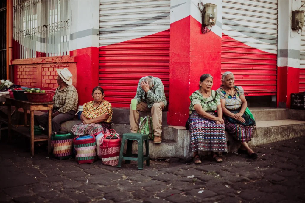
This region also has a strong Kaqchikel Maya presence. What’s more, the Kaqchikel language is spoken in municipalities across several departments, including Chimaltenango. You should know that travelling through Chimaltenango means exploring markets, as well as churches, viewpoints and country lanes that are sure to surprise you.
Why is Chimaltenango a key stop on the climb up Acatenango volcano?
Chimaltenango is a key starting point for climbing Acatenango Volcano, as several routes pass through the area. Furthermore, the village of La Soledad, one of the most common starting points, is part of the municipality of Acatenango.
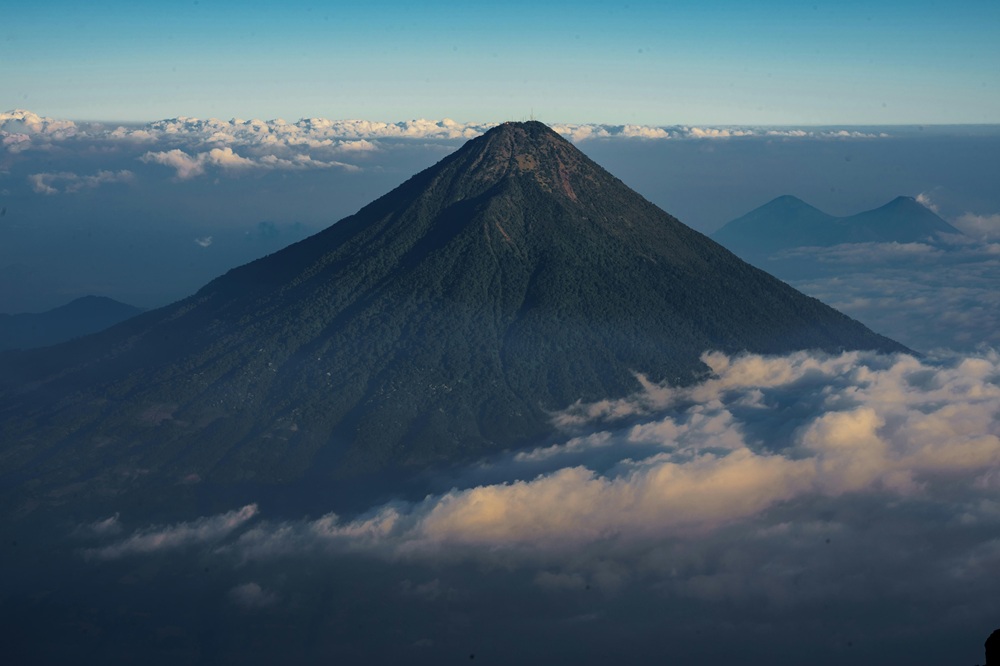
The journey to the start of the Acatenango trail is around 27 kilometres. We estimate it takes less than 44 minutes to reach the starting point. As a result, many travellers stay overnight in Antigua but then cross or skirt the department to reach the start of the hike.
Now that you know all this, if you’re thinking of doing the hike, there are a few things you need to bear in mind. One of them is that the climb from La Soledad can take between 5 and 6 hours to reach the summit, covering a climb of around 7 kilometres. Furthermore, the department is close to the Fuego volcano, one of the most active in Central America.
Main towns and landscapes of Chimaltenango
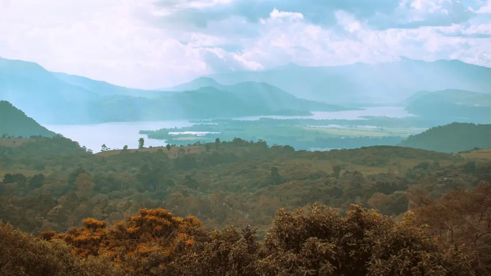
It's worth noting that the landscape of Chimaltenango varies greatly from one municipality to another. We will come across urban areas, farmland, villages with a strong indigenous identity, and mountains that dominate the horizon. We should therefore think of it as a diverse department, with a fairly bustling capital and rural municipalities that have a more leisurely pace.
To give you an idea, Tecpán is notable for the archaeological site of Iximché. Meanwhile, San Juan Comalapa is known for its cultural and artistic traditions. Meanwhile, Patzún retains a strong local identity and deeply-rooted celebrations. There are also Acatenango and San Pedro Yepocapa. Both are directly linked to the volcanic landscape and routes leading into the mountains.
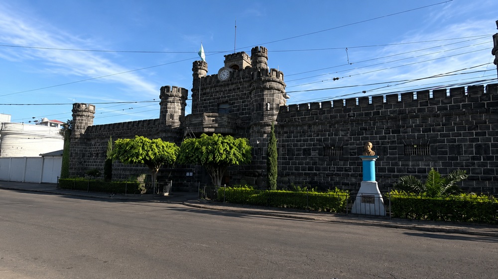
The departmental capital of Chimaltenango
The town centre of Chimaltenango is a convenient base from which to explore the region. It boasts markets, shops, transport links and access to the Inter-American Highway. Of all these, the market is one of the most interesting places to visit. From early in the morning, it’s bustling with fruit, vegetables, textiles, food stalls and a lively atmosphere.
You can also take a stroll through the town centre and head over to the main square. It’s a simple plan, but it helps you get a feel for the pace of life in Chimaltenango. Of course, if you’re short on time, the town centre might just be a quick stop. But if you’ve got more time, it’s a good place to stay the night before heading on to Tecpán, Acatenango or Antigua.
Rural areas, mountains and Kaqchikel Mayan communities
The interior of Chimaltenango has a more rural feel. This is evident in the towns and villages, where crops grow alongside ravines, forests, narrow roads and stunning open views. As we have mentioned, Kaqchikel culture is kept alive in many communities. This is evident in traditional dress and local festivals.
San Juan Comalapa, Tecpán and Patzún are good examples of this. You’ll be surprised by them because they offer a more authentic experience, as they aren’t always geared up for tourism.
- We invite you to read our article about San Pedro Las Huertas.
Chimaltenango as a gateway to nearby volcanoes and destinations
The truth is that Chimaltenango occupies a strategic position within Guatemala. Why? Because from here you can reach Antigua, Guatemala City, Tecpán, Iximché and routes leading to the volcanoes.
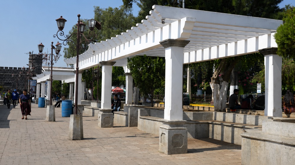
For many travellers, the department turns up, almost by surprise, along the way. But if you plan your itinerary well, it can become a stop that really makes sense and one you won’t regret. Before continuing on your way, you can spend half a day or a full day here. It all depends on whether you’re looking for culture, nature or perhaps adventure.
Roads linking Chimaltenango with Antigua and Guatemala City
It's worth noting that the Inter-American Highway is the main route for getting around Chimaltenango, as it connects the area with other parts of the highlands.
The town of Chimaltenango is about 55 kilometres from Guatemala City and about 25 kilometres from Antigua Guatemala, but journey times depend heavily on traffic. In particular, it's advisable to allow extra time when entering or leaving the capital, where rush-hour traffic can significantly lengthen the journey.
For travellers, this location makes it possible to combine a visit to Chimaltenango with a cultural tour of Antigua, outdoor activities or trips through the highlands. A useful tip is to set off early, check the traffic before setting off, and not rely solely on the distance in kilometres.
Chimaltenango: A gateway to excursions to other volcanoes
The truth is that Chimaltenango is a good base from which to explore some of Guatemala’s best-known volcanic trails. Without a doubt, the closest and most popular is Mount Acatenango. It's located within the department itself and is famous for its views of Volcán de Fuego, one of the most active volcanoes in Central America.
The hike up the Acatenango Volcano usually takes about two days and one night, involving an ascent to the campsite and a pre-dawn departure for the summit. It isn't an easy hike. Mainly because the volcano reaches an altitude of around 3,976 metres, so it's advisable to go with a guide, wear warm clothing and be reasonably fit.
From Chimaltenango, it's also easy to reach Antigua Guatemala, a common starting point for tours to Acatenango, Pacaya or scenic routes through the volcanic landscape. Before booking, always check the weather, the level of volcanic activity and access conditions, especially if the excursion includes areas near the Fuego volcano.
What to see in Chimaltenango
Chimaltenango doesn’t usually feature as a longer stop on classic itineraries around Guatemala. But the truth is that it’s a great way to add a touch of local colour between Guatemala City, Antigua and the highlands. The main attractions here are the markets, as well as the town squares, the rural landscapes and a few day trips to nearby lakes, farms and green spaces.
Local markets, churches and main squares
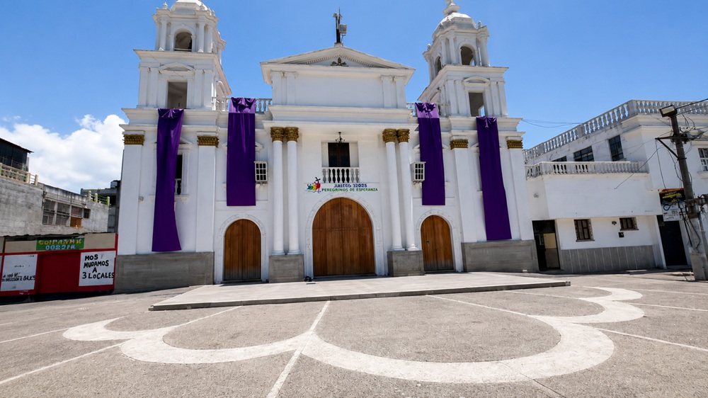
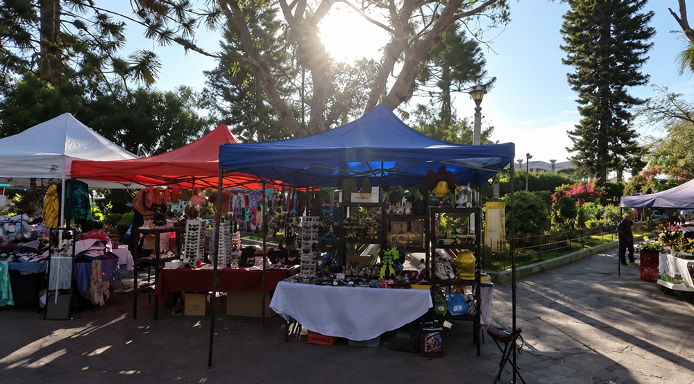
The centre of Chimaltenango is a good place to stop and observe everyday life in the department. Around the central park, the church and the shopping streets, you’ll find shops, eateries, fruit stalls, bakeries and stalls selling traditional food. This is a simple way to get a feel for the local pace of life before heading on to Antigua, Tecpán or the highlands.
The markets are worth a visit for their fresh produce, textiles and traditional food. If you go in the morning, you’ll find it livelier and a better atmosphere for grabbing a quick bite or buying some sweet bread. Remember to bring cash in quetzales and small notes.
Country estates, viewpoints and scenic routes in the surrounding area
The area around Chimaltenango offers more laid-back activities. It’s ideal if you’re looking to enjoy nature without undertaking a strenuous hike. Among the nearby options, Los Aposentos stands out: a national park in the municipality of Chimaltenango featuring a lagoon and natural pools, as well as areas for walking or al fresco dining.
There are also country estates, forests and rural areas that are ideal for a half-day getaway. Some places, such as Casa Xara y Molino and Laguna Chichoy, feature among the department’s tourist attractions. The latter is visited for its natural surroundings and activities such as fishing and camping. It's open from 9.00 am to 5.00 pm, with admission fees starting at around Q10 per person.
For other routes, it's best to head towards Tecpán, Patzún or the roads leading to the highlands. The landscape also features a mix of farmland, mountains and views of volcanoes.
Chimaltenango with a touch of adventure
Chimaltenango is also a great choice for a trip that combines nature and activity, without the need for extreme routes. In fact, the department offers a mix of country lanes, mountain villages, viewpoints and green spaces, making it easy to plan activities that won’t take up the whole day.
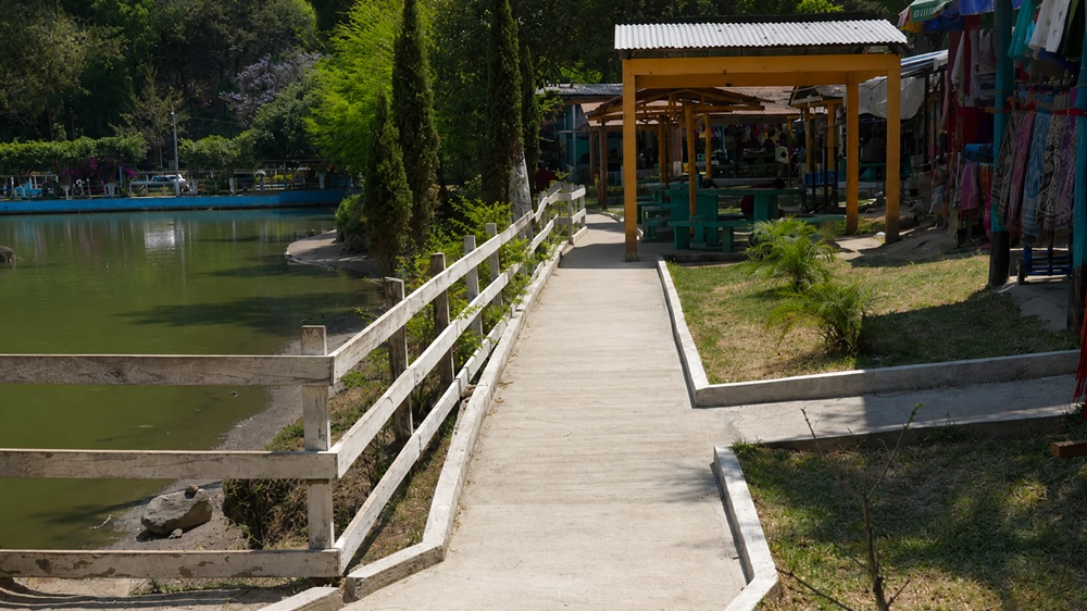
Easy walks and countryside trails in the interior of the department
For gentle walks, the best option is to look for routes around nature reserves, country estates and country lanes. That’s why there are always certain areas that are not to be missed, and among them we’d highlight San Andrés Itzapa. Because it’s an area where the landscape changes rapidly. You’ll come across farmland, forests, hillsides and sweeping views of the highlands.
There’s no need to think of it as a strenuous trek. Many routes are best enjoyed as short walks, with stops to take in the views or guided tours of local farms. Even so, it’s a good idea to wear comfortable shoes and carry a rucksack with essentials such as water and a light jacket, and to check the condition of the path beforehand, especially during the rainy season.
Short road trips between villages, viewpoints and nature reserves
One of the best ways to explore Chimaltenango is by car or private transport. That way, you can visit villages, viewpoints and natural attractions all in a single day. From the main town, you can head towards Tecpán, Patzún or Comalapa, with roads that wind through farmland and offer lovely mountain views. This is a great option if you want to get off the beaten track in Antigua without straying too far.
You could combine a visit to a local market in the morning, a meal on the go, a stop at a viewpoint and a visit to a nature reserve such as Los Aposentos. That would make for a perfect and thoroughly enjoyable day.
- We invite you to read our article about Alotenango.
Practical tips for visiting Chimaltenango and getting around the region
Visiting Chimaltenango is easy if you plan your travel arrangements carefully. It’s true that both traffic and the weather can cause plans to change more than we expect. That’s why it’s a good idea to allow plenty of time for each journey, especially if you’re planning to visit several places in a single day.
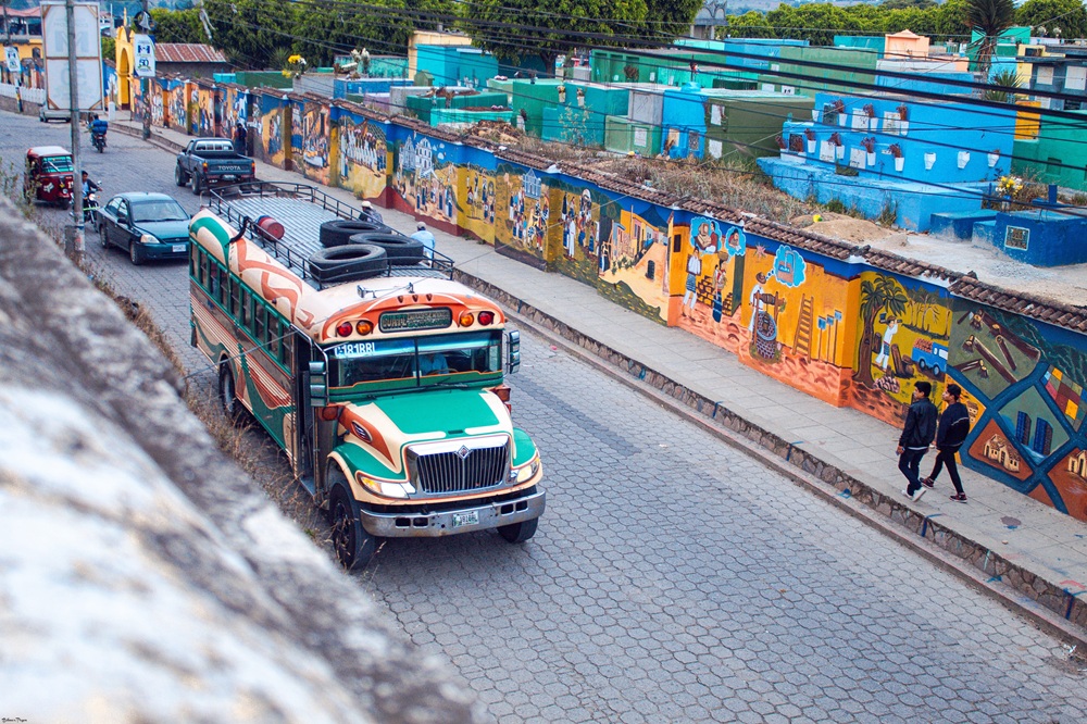
Transport, journey times and road conditions
If you want to visit villages, viewpoints and natural areas, the car is still the most convenient way to travel. There are also buses and local transport, but timetables are often less reliable and may involve several changes.
The Inter-American Highway CA-1 is the department’s main artery, linking Guatemala City, Antigua, Tecpán, Sololá and Quetzaltenango. However, it’s true that a short journey can take longer due to traffic, roadworks, rain or entering and leaving the capital. You should always bear this in mind!
Climate, what to pack and basic safety in the area
The weather in Chimaltenango is usually cool, especially at night and in higher areas. It’s best to wear a comfortable T-shirt, a light jacket or jumper, closed-toe shoes, and something waterproof if you’re travelling during the rainy season.
For countryside trips or gentle walks, make sure you take water, cash in quetzales, sun cream and enough battery power on your mobile. This is because in some villages or natural areas, it isn’t always easy to pay by card or get a stable signal.
When it comes to safety, it's advisable to take basic precautions such as avoiding minor roads at night, not leaving any items in plain sight in the car, and checking routes or timetables with accommodation providers or local people.
Frequently Asked Questions about Chimaltenango
Where is Chimaltenango?
Chimaltenango is located in the central region of Guatemala, between Guatemala City, Antigua Guatemala and the western highlands.
How do you get to Chimaltenango from Guatemala City?
The main route is the CA-1 Inter-American Highway, which links Guatemala City with the capital of Chimaltenango. The distance is around 55 kilometres.
Is it possible to visit Chimaltenango from Antigua Guatemala?
Yes. Chimaltenango is about 25 kilometres from Antigua Guatemala, so it can be visited as a half-day trip or as part of a wider itinerary.
What is there to see in Chimaltenango?
Some of the top recommendations include the centre of Chimaltenango, its local markets, churches, main squares and green spaces such as Los Aposentos.