In southern Guatemala, where the Pacific meets the waterways and mangroves, lies Iztapa. An unassuming town. The people make their living from fishing, the sea sets the pace, and tourism moves at a leisurely pace here.
You arrive, cross the channel by boat, step onto black sand and find yourself facing the Pacific. That’s it. No receptionists, no organised tours. That’s exactly why it’s worth it.
The municipality has a population of around 61,000 and covers an area of 328 km². It's not large. But the surrounding area, with its mangroves, waterways and dark-sand beaches, is one of the most interesting on Guatemala’s southern coast.
Here’s everything you need to know: what to see and do in Iztapa, how to get there, when to go and what’s nearby.

Where is Iztapa?
Iztapa is in the department of Escuintla, in southern Guatemala. It's situated on the Pacific coast, on the banks of the Chiquimulilla Canal, 108 km from Guatemala City.
The name comes from Nahuatl and means ‘a place where salt is plentiful’. It says a great deal about what this place was for centuries: a coastal settlement with a thriving trade. The climate is warm all year round, with temperatures ranging from 28–32 °C. You need to come prepared for the heat and humidity.
How to get there from Guatemala City
By car, it’s an hour and a half. Head out via the Aguilar Batres road, take the Palín–Escuintla motorway and follow the CA-9 south towards Puerto Quetzal. It’s straightforward.
By bus, from El Trébol or La Antigua. When you arrive at the port of San José, you have to cross the canal by boat. It takes a few minutes. Many hotels include this in the price.
There is no airport in Iztapa. The nearest one is in Guatemala City. If you’re flying, you’ll need to make a connection by bus or car hire.
Connections to nearby towns and destinations
Guatemala’s southern Pacific coast is well connected. The Port of San José is 13 km away, Monterrico Beach is 25 km away and the Monterrico Biotope and Nature Reserve is 32 km away. The Chiquimulilla Canal runs all the way to the border with El Salvador and is the link that connects all these places.
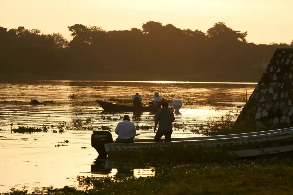
The CA-9 south is the backbone of the whole area. Travelling in your own car is the most convenient option if you want to combine a visit to Iztapa with other coastal destinations on the same trip.
History and heritage of Iztapa
Historical and cultural development
Iztapa and the sea have been one and the same from the very beginning. It already appeared on Spanish maps in 1527. In 1534, Pedro de Alvarado built a fleet of three ships here. Puerto Iztapa became Central America’s first naval shipyard on the Pacific coast. This is no small matter.
In 1590, the port was opened up for trade with the Far East, under the supervision of Don Pedro de Mellen de Rueda, President of the Royal Audience. From that moment on, Iztapa ceased to be merely a name on the coast.
Then came the first railway station in the southern part of the country. Another milestone. Another reason to realise that this municipality has always been more important than it appears at first glance.
Within the municipality there are also two sites of sacred significance to the Maya, known as ‘El Manacal’ and ‘El Cerrito’. They are situated on private land and have not been officially designated as heritage sites. However, they have formed part of the area’s identity since long before the arrival of the Spanish ships.
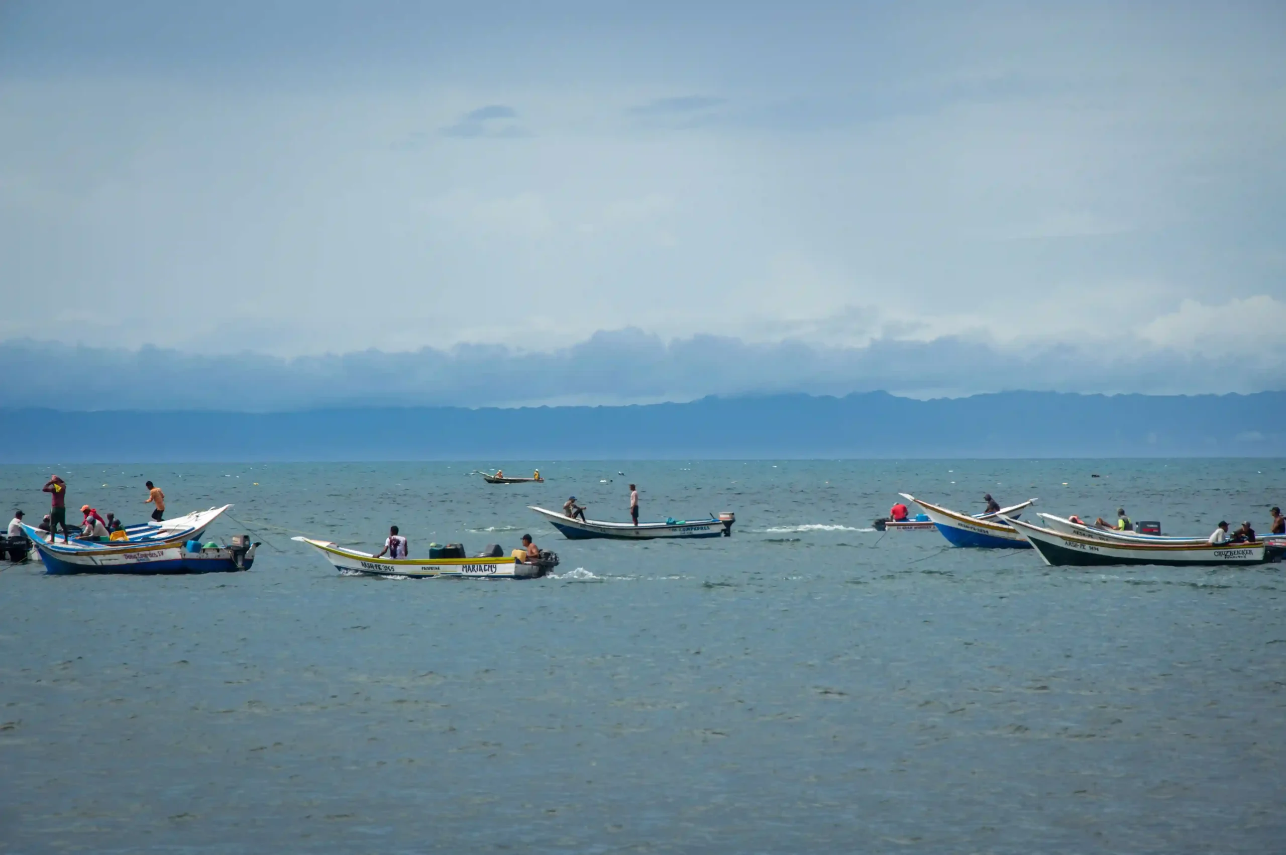
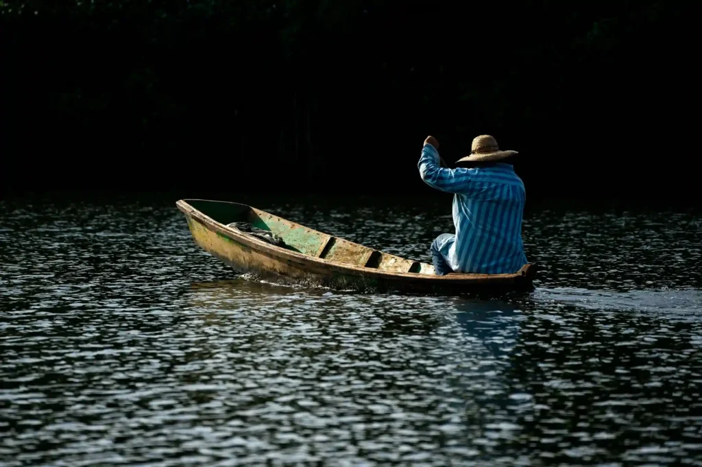
Today, the fishermen set out at dawn, just as they have done for centuries. The harbour remains the centre of everything.
Culture and traditions of Iztapa
Local festivals and celebrations
The patron saint is the Archangel Raphael. The feast day is 24 October. The highlight is the 'Paseo de San Rafael por el río' – a procession along the canal that has long been the symbol of the town.
During Holy Week, people flock in from the capital. It’s the busiest week of the year. If you’re looking for peace and quiet, give it a miss. If you’re after a lively atmosphere and beach life with the locals, this is the time to go.
Traditional cuisine of the municipality
Eating well in Iztapa is easy. And it doesn’t cost much. Everything revolves around the sea: fresh seafood, snapper ceviche, prawn ceviche, grilled fish. That’s what you’ll find in the harbour’s eateries.
Prawns really come into their own here. Small-scale fishing and the prawn farms on the Chiquimulilla Canal make this a top-quality local produce. Authentic flavours, with no gimmicks.
Prices are low. A plate of fresh seafood in a local eatery costs a fraction of what you’d pay in the capital. No menu, no tablecloths. Just proper food.
Crafts and cultural expressions
Iztapa does not have an organised craft market for visitors. What it does have is a working port: nets being mended, boats crossing the channel, people going about their work just as they always have.
The locals are mainly involved in small-scale fishing, agriculture and the ‘chalets’ – holiday homes let to tourists that form part of the coastal landscape. There are also people who work for the Quetzal Port Authority. That is the economy of Iztapa. Plain and simple.
- We invite you to read our article about Las Lisas Beach.
What to see in Iztapa
Iztapa Port
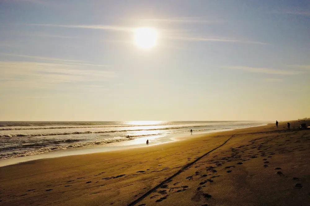
You cross the channel by boat, arrive at a strip of black volcanic sand, and the Pacific lies before you. No cars, no noise. Relaxing here is almost a must.
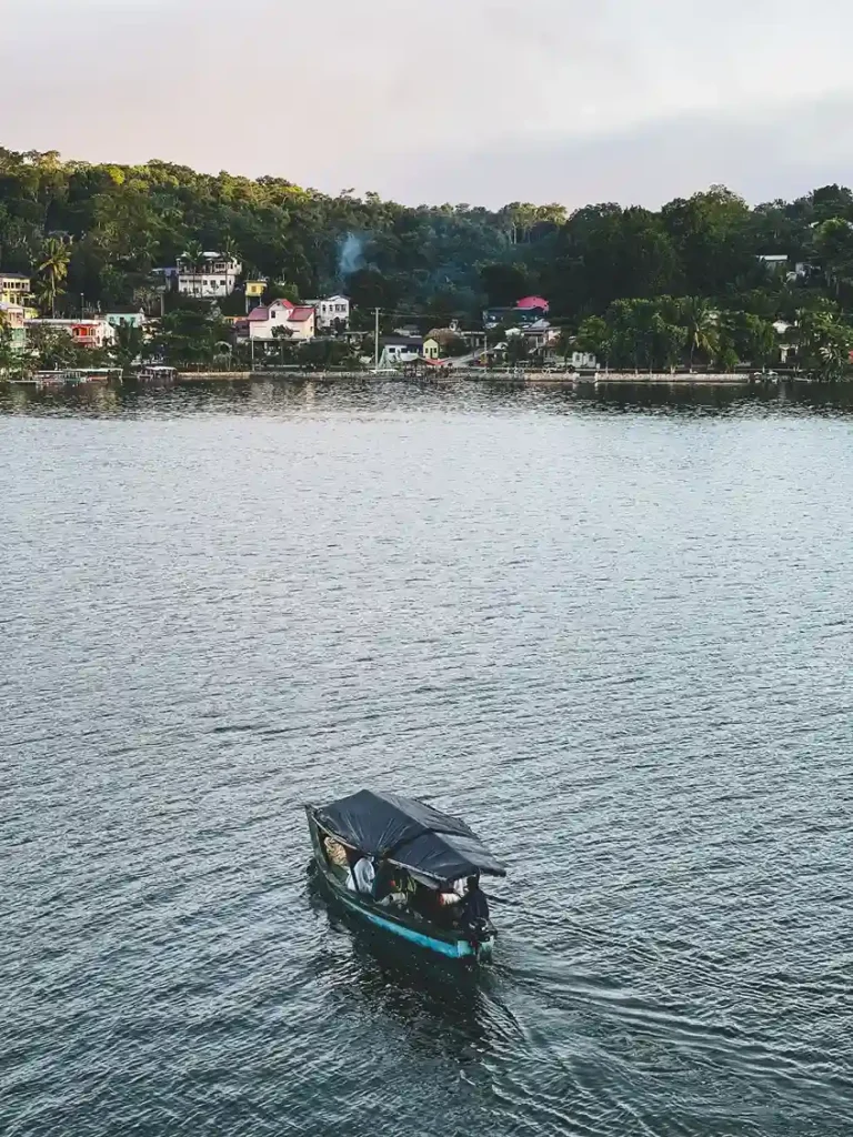
The dark sand is a characteristic feature of the entire Guatemalan Pacific coast. Here you can enjoy it with hardly anyone else around. It’s the perfect spot to eat seafood, go for a walk or simply gaze out at the sea without being disturbed.
There’s also space on the shore to go surfing when the conditions are right. And if you let your guard down, you’re very likely to end up chatting to a fisherman who’s been in the same spot all his life.
Chiquimulilla Canal
It stretches from the border with El Salvador to the Port of San José. It carries timber and prawns. It also connects villages that have no road links. And along its banks there are mangroves teeming with birds you wouldn’t expect to see.
Canoe trips are the best thing you can do here. Some accommodation providers offer them. If not, ask at the jetty. It’s a leisurely and enjoyable way to get a feel for this part of the Pacific.
Early in the morning, the canal has a different light about it. The herons in the mangrove swamp, the laden boats heading out to sea. It’s worth getting up early, even if it’s just for one day.
Beaches of black volcanic sand
Black sand. Volcanic. The beaches of Iztapa are unlike anything in the Caribbean or the Mediterranean. They have a different character. People go surfing here. There have been competitive events.
During the rainy season, the sea can get rough. Waves can reach up to 7 metres. From November to April, the water level drops, the waves are smaller and swimming is no longer an option.
- This page about El Paredón Beach may interest you.
Things to do in Iztapa
Recreational fishing
Iztapa is famous along the Guatemalan Pacific coast for one thing alone: sport fishing. Sailfish, marlin, dorado. Bountiful waters. Enthusiasts come from all over the region and from abroad.
There are several local companies offering private charters or shared tours. Ask at the harbour and compare prices before making a decision. The sport fishing season lasts practically all year round, although the busiest months are from November to May.
Boat trips along the canal
The simplest thing you can do in Iztapa – and the thing you’ll remember most. The canal, the mangroves, the fishing boats passing by. You can book it at the jetty or through your accommodation.
The price is negotiated directly with the boatman. There are no fixed rates. Ask how much he charges per hour and agree on the route before setting off.
Surfing on the Pacific beaches
The Pacific waves are great for surfing. In the right season, the conditions are good. Without the crowds found at other, better-known spots in Central America. Peaceful yet full of character.
There are no organised surf schools in Iztapa, but if you bring your own board, the beaches are there. During the rainy season, the waves are bigger. During the dry season, they’re more predictable.
Birdwatching in the mangrove forest
The mangrove forest along the Chiquimulilla Canal is a real ecosystem. Get up early, take a canoe and you’ll spot birds you weren’t expecting: herons, cormorants, kingfishers. Take some insect repellent. Mosquitoes are part and parcel of the experience.
Cuisine and port life
Sitting in a restaurant by the water, ordering a ceviche and watching the hustle and bustle of the harbour. That’s tourism too. Perhaps the best thing about Iztapa.
The most authentic eateries are near the jetty. No signs, no menu in English. You just point at what you want or ask for the dish of the day. It always works.
Best time to visit Iztapa
When to make the most of the beaches and the harbour
The dry season: from November to April. Calm seas, small waves, good conditions for swimming and fishing. This is when Iztapa is at its best.
From May to October, there are heavy showers in the afternoons. The sea gets rough. There are 7-metre waves and spectacular stormy sunsets, but the water isn’t safe for swimming. For those looking for a quiet beach, this isn’t the time to visit.
During Holy Week, there’s a lively atmosphere and plenty going on. If you’re looking to be on your own, that’s not the week for it. The rest of the year, on weekdays, Iztapa is practically deserted. That’s a huge advantage if you’re looking to really switch off.
Tips for visiting Iztapa
Transport and safety recommendations
To get to Puerto Iztapa, you have to cross the channel by boat. It takes a few minutes. It’s very cheap. Some hotels include it in the price. Ask when you book.
If you’re travelling by car, park on the mainland side. There’s no need to take your car across.
Iztapa is a quiet place. A word of advice: don’t leave valuables in plain sight. And if you’re heading to the mangroves or the canal, take insect repellent. It’s not optional.
The Pacific is powerful. Before you go in the water, take a look around, ask a local and use your common sense. Especially outside the dry season.
Take cash with you. There aren’t many cash machines in the area. It’s best to leave Guatemala City with enough cash to cover the whole trip.
- We invite you to read our article about Champerico.
What to see near Iztapa
Monterrico Beach
25 km away. The best-known beach on the Guatemalan Pacific coast. Black volcanic sand, a protected mangrove forest and sea turtles that come here to lay their eggs. Releasing turtles is one of those experiences you’ll never forget. More touristy than Iztapa, but nature still reigns supreme.
Monterrico Biotope and Nature Reserve
32 km away. Protected mangrove forest, Pacific coastal biodiversity. Birds, reptiles, turtles. If nature and conservation are your thing, this reserve is well worth a visit.
Port of San José
13 km away. Better known for its commercial activity than for tourism, but it does have a beach. The sunsets over the Pacific are its biggest draw. It also has better tourist facilities than Iztapa, so if you’re looking for more accommodation or dining options, it’s a nearby alternative.
Chapín Car Safari

21 km away. One of Guatemala’s most popular safari parks. Ideal if you’re travelling with your family or want to add something a bit different to your tour of the south coast. It goes well with a morning in Iztapa and an afternoon at the safari park.
Chiquimulilla Canal
We’ve already mentioned it above, but it deserves its own section as a destination. Mangroves, river life, waterways. A completely different perspective on this corner of Guatemala. It’s about more than just passing through to get to the beach.